Disclosure : This site contains affiliate links to products. We may receive a commission for purchases made through these links.
Canary Islands ITMB

Canary Islands at 1:130,000 on a double-sided map from ITMB. Each island is presented on a separate panel at the same scale and with an index. Bold altitude colouring shows the islands’ topography, with national parks prominently highlighted. Road network includes selected local roads and tracks. Ferry connections between the islands are marked. Symbols indicate various places of interest, included beaches, surfing and diving sites, etc. Latitude and longitude lines are drawn at 10’ intervals.The map includes insets with street plans indicating a few facilities and places of interest:- Tenerife: Santa Cruz de Tenerife, plus Puerto de la Cruz (wrongly annotated as on La Palma)- La Palma: Santa Cruz de la Palma, Los Llanos de Aridane, Los Cancajos and Puerto Naos- Gran Canaria: Las Palmas de la Gran Canaria- Lanzarote: Arecife-Fuerteventura: Ruerto del RosarioCorralejo and Morro Jable

Related Products:
 Canary Islands
 Canary Islands West: Gran Canaria, Tenerife, La Palma, Gomera, Hierro 500K CNIG Regional Map No. 14
 DK Eyewitness Travel Guide Canary Islands
 ATL3 Atlantic Islands: Azores, Madeira, Canary Islands, Cape Verde – 2018/19 Edition
 Cruising Guide to the Canary Islands
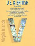
 Virgin Islands (US and British) ITMB
 The Canary Islands: A Cultural History
 Canary Islands East: Gran Canaria, Fuerteventura, Lanzarote 500K CNIG Regional Map No.
 Lonely Planet Canary Islands
 Tenerife F&B 2-Map Set WKE7
 Tenerife F&B
 Canary Islands Cruise Ports Marco Polo Pocket Guide – with pull out maps
 La Palma Kompass 232
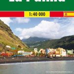
 La Palma F&B Pocket Map
 La Palma F&B
 Tenerife Kompass 233
 Virgin Islands Borch
 La Palma F&B WKE2
 Caribbean Islands Western Half ITMB Travel Atlas
 Bolivia ITMB
 Polynesian Islands ITMB Travel Atlas
 Canary Islands II: Tenerife and La Gomera – Spain: II
 Watsonville – Santa Cruz – Scotts Valley CA
 Tenerife K+F Outdoor Map
 Berlitz Pocket Guide Canary Islands
 Bahamas ITMB
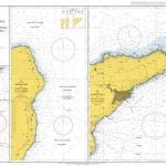 Admiralty Chart 1858 – Apps. to S. Cruz de Tenerife- Puerto de San Sebastian de la Gomera- San Cruz de la Palma and Apps.
 Gran Canaria Kompass 237
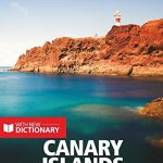
 Insight Guides Pocket Canary Islands
 Caribbean Islands East & South ITMB Travel Atlas
 Spain: Kompass Maps of the Canary Islands
 Cayman Islands & Jamaica ITMB
 Canary Islands Michelin Zoom 125
Puerto Rico & US Virgin Islands ITMB
Canary Islands Michelin Zoom 125
Puerto Rico & US Virgin Islands ITMB
 ES2 Balearic Islands, Ibiza to Menorca – 2018/19 Edition
 Tahiti & Cook Islands ITMB
Solomon Islands & South Pacific Ocean ITMB
Tahiti & Cook Islands ITMB
Solomon Islands & South Pacific Ocean ITMB
 Admiralty Chart 539 – Puerto Santa Cruz to Cabo Pilar including the Falkland Islands
 Gran Canaria Marco Polo Holiday Map
 DK Eyewitness Top 10 Gran Canaria