Disclosure : This site contains affiliate links to products. We may receive a commission for purchases made through these links.
Canary Islands

Canary Islands at 1:150,000 on a map from MairDumont with each island presented on a separate panel, plus street plans of central Santa Cruz de Tenerife and Las Palmas de Gran Canaria. A special feature of the ‘Marco Polo” maps and atlases is a set of seven peel-on/peel-off stickers which can be placed on the maps to help with navigating and removed without damaging the surface. The island’s topography is presented by unobtrusive relief shading with spot heights. National parks and other protected areas are highlighted. Road network emphasizes main and secondary routes, both shown with driving distances, but also includes local road and tracks. Scenic roads are highlighted. Ferry connections are also marked. Places of interest, including landscape features, are prominently highlighted and given star rating. The panels have no geographical coordinates. The index is in a separate booklet attached to the map cover. Map legend includes English.Also provided is a small map of the whole Canary Islands archipelago showing ferry connections, plus street plans of central Santa Cruz de Tenerife and Las Palmas de Gran Canaria.

Related Products:
 Canary Islands ITMB
 Canary Islands West: Gran Canaria, Tenerife, La Palma, Gomera, Hierro 500K CNIG Regional Map No. 14
 DK Eyewitness Travel Guide Canary Islands
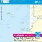 ATL3 Atlantic Islands: Azores, Madeira, Canary Islands, Cape Verde – 2018/19 Edition
 Canary Islands East: Gran Canaria, Fuerteventura, Lanzarote 500K CNIG Regional Map No.
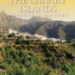 The Canary Islands: A Cultural History
 Lonely Planet Canary Islands
 Canary Islands Cruise Ports Marco Polo Pocket Guide – with pull out maps
 Cruising Guide to the Canary Islands
 Canary Islands II: Tenerife and La Gomera – Spain: II
 Berlitz Pocket Guide Canary Islands
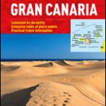
 DK Eyewitness Top 10 Gran Canaria
 Insight Guides Pocket Canary Islands
 Canary Islands: A Cultural History
 111 Places in Gran Canaria That You Shouldn`t Miss
 Gran Canaria Marco Polo Holiday Map
 Las Palmas de Gran Canaria CNIG Topo 1098
 Tenerife F&B 2-Map Set WKE7
 Trekking in the Canary Islands: The GR131 island-hopping route
 Tenerife F&B
 Iberian Peninsula – Balearic Islands – Canary Islands CNIG Physical Wall Map
Santa Cruz de Tenerife CNIG Topo 1089
Canary Islands CNIG RAISED RELIEF Map
Spain: Kompass Maps of the Canary Islands
Iberian Peninsula – Balearic Islands – Canary Islands CNIG Physical Wall Map
Santa Cruz de Tenerife CNIG Topo 1089
Canary Islands CNIG RAISED RELIEF Map
Spain: Kompass Maps of the Canary Islands
 Walking on Gran Canaria: 45 day walks including five days on the GR131 coast-to-coast route
 Canary Islands: Fuerteventura and Lanzarote – Spain: Vol. 1
 A Birdwatchers` Guide to the Canary Islands
 Gran Canaria Kompass 237
 Canary Islands Michelin Zoom 125
DK Eyewitness Canary Islands
Spain: 50K Canary Islands Civilian Topographic Survey
Canary Islands Michelin Zoom 125
DK Eyewitness Canary Islands
Spain: 50K Canary Islands Civilian Topographic Survey
 Spain: 25K Canary Islands Civilian Topographic Survey
 Okinawa & the Ryukyu Islands Periplus Travel Map
 Canary Islands Globetrotter Travel Guide
 Gran Canaria F&B WKE5
 Wildlife of Madeira and the Canary Islands: A Photographic Field Guide to Birds, Mammals, Reptiles, Amphibians, Butterflies and Dragonflies
Las Palmas de Gran Canaria 25K CNIG Topographic Survey Map No. 1098-IV
Wildlife of Madeira and the Canary Islands: A Photographic Field Guide to Birds, Mammals, Reptiles, Amphibians, Butterflies and Dragonflies
Las Palmas de Gran Canaria 25K CNIG Topographic Survey Map No. 1098-IV
 Gran Canaria F&B
 Papua & Maluku Islands Nelles
 Gran Canaria Marco Polo Pocket Travel Guide 2018 – with pull out map