Disclosure : This site contains affiliate links to products. We may receive a commission for purchases made through these links.
Canada: NGS Trails Illustrated Maps of Banff and Jasper
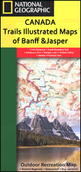
Canadian Rockies on four double-sided, contoured, GPS compatible recreational maps at 1:100,000 from the National Geographic printed on light, waterproof and tear-resistant synthetic paper. The maps show numerous hiking, horse riding and biking trails, accommodation facilities, etc.Each map is double-sided to cover a wider area. Topography is very vividly presented by contours at 30m intervals enhanced by relief shading and altitude colouring. Heights are given both in feet and metres. Boundaries of the regionโ€s numerous protected areas indicate their official status, from national parks to provincial natural areas.Road network shows improved roads, routes requiring high clearance vehicles and restricted access administrative roads. The marking for maintained trails differentiates between routes for hiking and horse riding and those also suitable for bikes. The trails are annotated with distances in both miles and kilometres. A very wide range of symbols highlights local facilities and recreational areas: different types of accommodation including campgrounds, cabins and hostels, parking and picnic areas, trailheads, horse riding facilities, boat tours, etc. The maps have a 1-km UTM grid plus latitude and longitude crosshairs at 10โ€. Each title also includes general information about the region, safety tips and useful contact details.

Related Products:
 Jasper South – Jasper National Park
 Jasper North – Jasper National Park
 Banff North – Banff and Yoho National Parks
 Banff South – Banff & Kootenay National Parks
 Canada: Gem Trek Hiking Maps of the Banff & Jasper National Parks & the Canadian Rockies
 USA: Trails Illustrated Maps of National Parks, Forest and Other Recreational Areas
 Ogden – Monte Cristo Range UT NGS Trails Illustrated Map 700
 Catskill Park NY NGS Trails Illustrated Map 755
 Allegheny National Forest North PA/NY NGS Trails Illustrated Map 738
 Weminuche Wilderness CO NGS Trails Illustrated Map 140
 Shawangunk Mountains NY NGS Trails Illustrated Map 750
 Tarryall Mountains CO NGS Trails Illustrated Map 105
 Bend – Three Sisters OR NGS Trails Illustrated Map 818
 Germany: Kรผmmerly+Frey Hiking and Recreational Maps
 Crater Lake National Park OR NGS Trails Illustrated Map 244
 Kachemak Bay State Park AK NGS Trails Illustrated Map 763
 Channel Islands National Park CA NGS Trails Illustrated Map 252
 North Fork – Glacier National Park MT NGS Trails Illustrated Map 313
 Flat Tops North CO NGS Trails Illustrated Map 150
 Flat Tops South CO NGS Trails Illustrated Map 151
 Yampa – Gore Pass CO NGS Trails Illustrated Map 119
 Mt Jefferson – Mt Washington Wilderness OR NGS Trails Illustrated Map 819
 Mount Hood Wilderness OR NGS Trails Illustrated Map 321
 Caribbean National Forest – Puerto Rico NGS Trails Illustrated Map 790
 Finland: Karttakeskus 250K/400K Outdoor Maps
 Big South Fork National Recreation Area KY/TN NGS Trails Illustrated Map 241
 Cowdrey – North Sand Hills CO NGS Trails Illustrated Map 113
 Prince William Sound West AK NGS Trails Illustrated Map 761
 Black Mesa – Curecanti Pass CO NGS Trails Illustrated Map 134
 Indian Peaks – Gold Hill CO NGS Trails Illustrated Map 102
 Clinch Ranger District – Jefferson National Forest VA/KY NGS Trails Illustrated Map 793
 Fontana and Hiwasee Lakes – Nantahala National Forest NC NGS Trails Illustrated Map 784
 Winter Park – Central City – Rollins Pass CO NGS Trails Illustrated Map 103
 French Broad & Nolichucky Rivers – Cherokee & Pisgah NFs TN/NC NGS Trails Illustrated Map 782
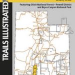 Paunsaugunt Plateau – Mount Dutton – Bryce Canyon UT NGS Trails Illustrated Map 705
 Harriman – Bear Mountain – Sterling Forest State Parks NY NGS Trails Illustrated Map 756
 Yosemite SW – Yosemite Valley and Wawona CA NGS Trails Illustrated Mpa 306
 Austria: Kรผmmerly+Frey Recreational Maps
 France: Kummerly + Frey Recreational Maps of the Vosges Mountains and Alsace
 Germany: Rhineland-Palatinate 50K Topographic Survey Recreational Maps