Disclosure : This site contains affiliate links to products. We may receive a commission for purchases made through these links.
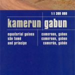
Cameroon & Gabon ITMB
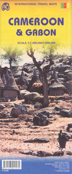
Indexed, double-sided map showing on one side Cameroon at 1:1,500,000 and on the reverse Gabon with Equatorial Guinea at 1:950,000, with street plans of Yaounde, Douala and Librรฉville.Both maps have altitude colouring with spot heights and indicate wetlands, swamps and mangrove areas. Elevation in Cameroon is shown in feet, whilst in Gabon in metres. Road network includes unpaved roads and tracks and indicates locations of petrol supplies and border crossings. National parks and protected areas are highlighted and symbols show tourist accommodation and campsites, churches and missions, various places of interest, hospitals and medical facilities, etc. Each map is indexed and has latitude and longitude lines at intervals of 1ยบ. Basic street plans are provided for Yaounde, Douala and Librรฉville.Equatorial Guinea is shown with Gabon at 1:950,000, with Bioko Island as an inset at 1:500,000.

Related Products:
 Cameroon & Gabon Reise-Know-How Map
 Nigeria & Niger ITMB
 Africa Northwest ITMB
 Africa Equatorial ITMB
 Malawi & Mozambique ITMB
 Cameroon IGN 85030
 Guyana, Suriname & French Guiana ITMB
 Nova Scotia & Prince Edward Island ITMB
 Philadelphia & Mid-Atlantic States ITMB
 Georgia & Armenia ITMB
 Mauritius & Reunion ITMB
 California ITMB
 Western & Northern Canada ITMB Travel Atlas
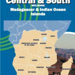 Africa Central & South Map Studio
 Hawaii & Honolulu ITMB
 Cayman Islands & Jamaica ITMB
 Quito & Central Ecuador ITMB
 Senegal & Gambia ITMB
 Vietnam ITMB
 Thailand, Vietnam, Laos & Cambodia ITMB Travel Atlas
 Sri Lanka & India South ITMB
 Albania ITMB
 Bolivia ITMB
 Bhutan & Northeast India ITMB
 Virgin Islands (US and British) ITMB
 Colombia ITMB
 Thailand ITMB
 Dominica & Saint Lucia ITMB
 Africa ITMB
 New Guinea (Papua New Guinea and Indonesia) ITMB
Zambia & Eastern Africa ITMB Road Map
New Guinea (Papua New Guinea and Indonesia) ITMB
Zambia & Eastern Africa ITMB Road Map
 Bali & Lombok ITMB
 Southern Vietnam – Mekong Delta ITMB
 Auckland & North Island ITMB
 Accra & Ghana South ITMB
 Sudan ITMB
 Farmington, NM – Durango, CO – Cortez, CO
 Guatemala ITMB