Disclosure : This site contains affiliate links to products. We may receive a commission for purchases made through these links.
Cambodia – the Khmer Legacy Odyssey Illustrated Map
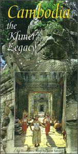
Cambodia at 1:1,000,000 on a map/guide from Odyssey Books with extensive text accompanied by colour photos describing the country’s 19 main tourist attractions, including temples, beaches, wildlife and nature, etc.The map shows the network of main road and rail connections, plus regional airports. Relatively fewer smaller towns and villages are marked than on other maps of Cambodia, so that places most visited by tourists are easy to find. National parks, reserves and wildlife sanctuaries are prominently highlighted. The map provides a very vivid picture of the country’s topography, with mountainous regions contrasted by relief shading and colouring from the lowlands. Latitude and longitude lines are drawn at 1ยบ intervals. Eight of the descriptions cover the sights within the Angkor UNESCO World Heritage Site, with two more for locations in the nearby Kulen Mountains.On the reverse is a map of the Greater Mekong Sub-region, covering south-eastern Asia from the source of the river on the Tibetan plateau to the delta. Similar presentation of the topography includes names of numerous mountain ranges, main rivers and lakes. The map shows country borders, the network of main roads and railway lines, and highlights various places of interest.

Related Products:
 Cambodia – Angkor Nelles
 Enchanting Cambodia (2nd edition)
 Cambodia Periplus Travel Map
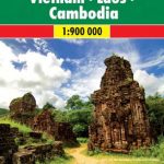
 Vietnam – Laos – Cambodia Wall Map
 An Illustrated History of Cambodia
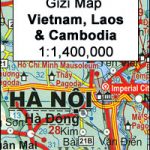
 Vietnam – Laos – Cambodia Gizi Map
 Presenting Cambodia
 Cambodia Reise Know-How
 Thailand, Vietnam, Laos & Cambodia ITMB Travel Atlas
 Cambodia Gecko Map
 The Mekong River from Source to Sea Odyssey Map
 Indochina: Vietnam – Laos – Cambodia Reise Know-How
 Vietnam, Laos & Cambodia ITMB
 Cambodia & Mekong Delta ITMB
 Vietnam – Laos – Cambodia Nelles
 Myeik Archipelago & Myanmar (Burma) Odyssey Map
 Vietnam, Laos & Cambodia Flexi Map
 Thailand – Vietnam – Myanmar / Burma – Cambodia – Laos Marco Polo Map
 Vietnam – Laos – Cambodia F&B
 Lonely Planet Cambodia
 Insight Guides Laos & Cambodia
 DK Eyewitness Travel Guide Cambodia and Laos
 Angkor and the Khmer Civilization
 Laos & The Mekong River from Source to Sea Odyssey Map
 The Rough Guide to Cambodia
 Philippines Odyssey Map
 Vietnam, Cambodia & Laos Insight Travel Map
 Malaysia Odyssey Map
 Cambodia: Leap and Hop Series
 Vietnam, Cambodia & Laos
 Cambodia`s Curse: The Modern History of a Troubled Land
 Montenegro
 Remembering Cambodia
 Mexico ITMB
 China Gizi Map Geographical Wall Map
 Bulgaria Cartographia Road Map
 Cambodia – The Land and People
 Albania ITMB
 Malawi Map Studio Adventure Map
 Myanmar / Burma F&B