Disclosure : This site contains affiliate links to products. We may receive a commission for purchases made through these links.
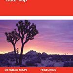
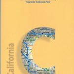
California Benchmark Road Map
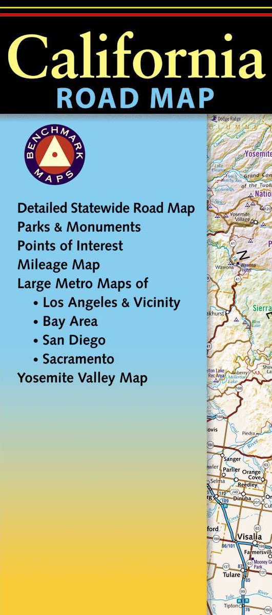
California at 1:1,318,821 in a series of very detailed state maps of the western states of USA from Benchmark Maps designed to highlight national/state parks or forests and other protected areas, and to provide information on recreational possibilities, campgrounds and RV parks, etc.The base map is derived from satellite imagery to show the topography, with plenty of names of individual mountain ranges, peaks, valleys, etc. Colouring is used to distinguish between various types of protected areas and land in public ownership, from BLM (Bureau of Land Management) lands to wilderness or wildlife areas. Indian Reservations and military zones are also marked. Some titles also provide additional information such as the numbering of hunting zones, etc.Road network indicates tracks requiring high clearance or 4WD vehicles. A very wide range of symbols identifies recreational possibilities and indicates locations of campgrounds and RV parks, trailheads, various places of interest, etc. The maps have no geographical coordinates.IN THIS TITLE: the overprint for recreational facilities on this map is less extensive than on other titles in the series and no additional lists of recreational facilities are provided. Instead, the map has an index of towns/cities and counties plus enlargements at for: Los Angeles and Vicinity extending inland to San Bernardino and Moreno Valley; San Francisco Bay area from San Jose to Richmond and San Rafael in the north and inland to Antioch; San Diego and Vicinity; Sacramento; Monterey; Palm Springs area; Yosemite Valley up to the Tioga Pass in the north; Lake Tahoe including the Nevada side with Carson City; Napa and Sonoma Valley to the Pacific Coast; and the the Redwood Coast

Related Products:
 Utah Benchmark Recreation Map
 USA: Benchmark Maps State Road Maps
 Idaho Benchmark Recreational Map
 Oregon Benchmark Recreational Map
 Washington State Benchmark Recreation Map
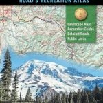
 California Benchmark Road & Recreation Atlas
 Northern California Benchmark Road Map
 Wyoming Benchmark Road & Recreation Atlas
 Arizona Benchmark Road & Recreation Atlas
Oregon Benchmark Road & Recreation Atlas
Arizona Benchmark Road & Recreation Atlas
Oregon Benchmark Road & Recreation Atlas
 Idaho Benchmark Road & Recreation Atlas
 Montana Benchmark Road & Recreation Atlas
 New Mexico Benchmark Road & Recreation Atlas
USA: Benchmark Road and Recreational Atlases of Western USA
New Mexico Benchmark Road & Recreation Atlas
USA: Benchmark Road and Recreational Atlases of Western USA
 Oregon & Northern California Coast Road & Recreation Map
 California DeLorme Atlas & Gazetteer
 Highway 395 – Carson City NV to Lone Pine CA Benchmark Road Map
 California Easy-to-Read Rand McNally
 California Road Map Global Graphics
 California – Nevada USA 05 Hallwag Road Map
 California Southern Easy to Fold Rand McNally
 California De Long Wine Wall Map
 Washington State Road & Recreation Atlas
 Canada: Go Trekkers Maps of National Parks
 USA: DeLorme State Road Atlases
 Montana Benchmark Recreation Map
 California Borch
 Oregon Road & Recreation Atlas
 Arkansas Recreational Atlas & Gazetteer
 Florida Recreational Atlas & Gazetteer
 New Mexico Benchmark Recreation Map
 Nevada Road & Recreation Atlas
 North Dakota DeLorme Atlas & Gazetteer
 North Carolina Recreational Atlas & Gazetteer
 Oklahoma Benchmark Recreation Map
 Eastern Texas Benchmark Recreation Map
 Western Texas Benchmark Recreation Map
 Moon Southern California Road Trip
 Moon West Coast RV Camping: The Complete Guide to More Than 2,300 RV Parks and Campgrounds in Washington, Oregon, and California
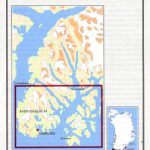
Auyuittuq National Park, Nunavut
Moon West Coast RV Camping: The Complete Guide to More Than 2,300 RV Parks and Campgrounds in Washington, Oregon, and California
Auyuittuq National Park, Nunavut