Disclosure : This site contains affiliate links to products. We may receive a commission for purchases made through these links.
C41 Les Sables d`Olonne to la Gironde

This Imray’s series of charts for the Western Europe includes comprehensive and easy-to-use sailing charts published on rip-proof, waterproof paper- ideal for use on small tables or in cockpits. They show detailed coastline and depth information, and are constantly corrected to reflect latest information. Designed primarily for yachtsmen, they are comprehensive without being unnecessarily cluttered.Each chart contains insets showing local harbours annotated with symbols indicating what facilities can be found there (marinas, mooring and berth facilities, fuel, water, chandlers, etc.). Charts are fully updated to the latest printing date, and often include further corrections on a separate sheet. Subsequent corrections can be found on the Imray website.On this chart, depths are shown in metres. Positions referring to WGS84 Datum, such as most GPS readings, can be plotted directly onto this chart.Base cartography uses contours, several levels of colour shading, and spot measurements to indicate depth relative to Lowest Astronomical Tide, including distinct colour highlighting for tidally-covered land. A large number of hatchings & markings are used to indicate coast types, salt flats, marshland, reefs, etc.Compliant IALA ‘System A’ buoys are clearly marked, and indications of other navigational aides such as light floats are given where possible. Lighthouses are clearly marked with arcs of visibility. A complex and comprehensive system of symbols is used to indicate all types of submerged obstructions, including wrecks, rocks, pipelines and cables, with depths where known. Flood tides, eddies races, ebb tide streams and other current information is given. A wide range of symbols indicate onshore features, anchorages, harbour details and other points of note. Danger areas, restricted areas and traffic zones are all shown.Plans on this chart:Bourgenay Approach to Jard-sur-Mer Approach to Ars-en-Re Approach to St Martin-de-Re; Approach to La Flotte-en-Re Rade de la Pallice La Rochelle and Port des Minimes St-Denis-d`Oleron Douhet Boyardville Rochefort Royan Port Medoc 2010 Edition updated throughout, with fully updated lights and buoyage in Rade de la Pallice, Pertuis de Maumusson and the approaches to La Gironde. In addition, a new plan of Port Medoc has been added to the chart.

Related Products:
 SHOM Chart 7411 – Port des Sables d’Olonne
SHOM Chart 7411L – Port des Sables d’Olonne – Leisure A4 size
SHOM Chart 7411 – Port des Sables d’Olonne
SHOM Chart 7411L – Port des Sables d’Olonne – Leisure A4 size
 Admiralty Chart 3638 – Les Sables d`Olonne
 Admiralty Chart 2998 – Les Sables – D`Olonne to Ile de Re
 SHOM Chart 7403 – Des Sables d’Olonne ร l’รle de Rรฉ
 C40 Le Croisic to Les Sables-d`Olonne
 Admiralty Chart 2522 – Presqu`ile de Quiberon to Sables-d`Olonne
 SHOM Chart 7068 – De la Presqu’รฎle de Quiberon aux Sables d’Olonne
 SHOM Chart 7402 – De Saint-Jean-de-Monts aux Sables-d’Olonne
 SHOM Chart 7403L – Des Sables d’Olonne ร l’รle de Rรฉ – Leisure A4 size
 C58 Trevose Head to Bull Point
 C39 Lorient To Le Croisic
 M23 Adriatic Sea Passage Chart 2020
SHOM Chart 7402L – De Saint-Jean-de-Monts aux Sables-d’Olonne – Leisure A4 size
M23 Adriatic Sea Passage Chart 2020
SHOM Chart 7402L – De Saint-Jean-de-Monts aux Sables-d’Olonne – Leisure A4 size
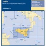 M31 Sicily
 M6 Ile de Corse
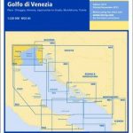 M34 Golfo di Venezia
 M7 Bonifacio Strait
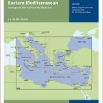 M20 Eastern Mediterranean
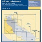 M33 Adriatic Italy North
 G23 Marmara Denizi
 M9 South Sardegna SUPERCEDED
 M9 South Sardegna
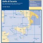 M29 Golfo di Taranto
 M45 Tuscan Archipelago
 M25 Otok Rab to Sibenik
 M50 Sardegna to Ionian Sea
 G22 Northeast Aegean Sea
 G21 Northwest Aegean Sea
 M32 Adriatic Italy South
 G3 Aegean Sea (South)
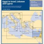 M22 Egypt to Israel, Lebanon and Cyprus
 M19 Capo Palinuro to Punta Stilo
 C14 Plymouth Harbour and Rivers
 C52 Cardigan Bay to Liverpool
 C20 Gibraltar to Acores and Islas Canarias
 C18 Western Approaches to the English Channel & Biscay
 M21 South Coast of Turkey, Syria, Lebanon & Cyprus
 C33A Channel Islands
 G38 Nisos Kriti (East)