Disclosure : This site contains affiliate links to products. We may receive a commission for purchases made through these links.
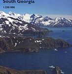
Busen Region – South Georgia BAS Wall Map
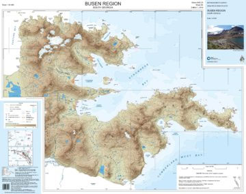
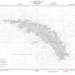
South Georgia and its offshore islands in the South Atlantic presented by the British Antarctic Survey on a double-sided map combining topographic mapping of the whole island at 1:200,000 scale and detailed topographic mapping of the route of Shackleton’s crossing in May 1916 at 1:40,000 scale.On one side is a map presenting the topography by contours at 100 m intervals with numerous trigonometric heights and spot heights. Colouring and graphics indicate ice-free terrain and moraine. Numerous glaciers, peaks, bays, etc, are named and the map shows locations of research stations and disused whaling stations.On the reverse side is a map covering the route which Sir Ernest Shackleton took during the first ever crossing of South Georgia from King Haakon Bay. This 1:40,000 scale map uses data created from VHR satellite imagery including contours at 50 m intervals and spot heights of the main peaks. This side also has 1:25,000 scale insets of key areas along the crossing, and a cross section showing elevation along the route.Exploratory notes provide historical background on South Georgia and full technical specifications including data sources and references. Full BAS reference for this title is “Sheets BAS (Misc) 12A and 12B”. This title is also available flat.

Related Products:
 Busen Region – South Georgia BAS
 South Georgia – The Shackleton Crossing BAS Wall Map
 South Georgia Explorer
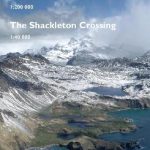 South Georgia – The Shackleton Crossing
 Thatcher Peninsula – South Georgia BAS Wall Map
 St Andrews Bay – Royal Bay, South Georgia BAS Geomorphology Wall Map
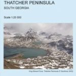 Thatcher Peninsula – South Georgia BAS
St Andrews Bay – Royal Bay, South Georgia BAS Geomorphology Map
Thatcher Peninsula – South Georgia BAS
St Andrews Bay – Royal Bay, South Georgia BAS Geomorphology Map
 A Field Guide to the Wildlife of South Georgia
 South Georgia BAS Geological Map 4
South Shetland Islands BAS Wall Map
South Georgia BAS Geological Map 4
South Shetland Islands BAS Wall Map
 Cape Region – South Africa Reise Know-How
 Georgia Geoland Road Map WATERPROOF
Admiralty Chart D3597 – South Georgia, Territorial Baseline
Georgia Geoland Road Map WATERPROOF
Admiralty Chart D3597 – South Georgia, Territorial Baseline
 Georgia State Physical Wall Map
Georgia
Georgia State Physical Wall Map
Georgia
 Georgia: Geoland 50K Trekking Maps
Admiralty Chart Folio 96 – East Coast of South America – Punta Piedras to Puerto Gallegos incl. Falkland Islands, South Georgia
Georgia: Geoland 50K Trekking Maps
Admiralty Chart Folio 96 – East Coast of South America – Punta Piedras to Puerto Gallegos incl. Falkland Islands, South Georgia
 South East & Central England A-Z Wall Map PAPER
 Graham Land and South Shetland Islands – Scotia Sea
 Georgia & Armenia ITMB
 Admiralty Chart 3595 – South Georgia Central Sheet
 NGA Chart 29040 – South Georgia
 Birds of Chile – Including the Antarctic Peninsula, the Falkland Islands and South Georgia
 Admiralty Chart 3582 – Harbour and Anchorages in South Georgia, Sheet 3
Admiralty Chart 3586 – Harbours and Anchorages in South Georgia, Sheet 2
Admiralty Chart 3582 – Harbour and Anchorages in South Georgia, Sheet 3
Admiralty Chart 3586 – Harbours and Anchorages in South Georgia, Sheet 2
 China South Wall Map
 Admiralty Chart 3588 – South Georgia, Approaches to Stromness & Cumberland Bays
 Antarctica Reise Know-How
 Georgia: Geoland 200K Regional Travel Maps
 South Africa NGS Classic Wall Map PAPER
 Moon Georgia
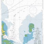
 Admiralty Chart 4207 – Falkland Islands to Cabo Corrientes and South Georgia Rise
 South West Coast Path 4 – South Devon Adventure Atlas
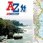 South West Coast Path 3 – South Cornwall A-Z Adventure Atlas
 Admiralty Chart 4206 – Tristan da Cunha Group to Discovery Seamounts and South Georgia Rise
 South Africa NGS Classic Wall Map ENCAPSULATED
 Georgia O`Keeffe 2022 Mini Wall Calendar
 South Tyrol Cycle Region Bikeline Map-Guide