Disclosure : This site contains affiliate links to products. We may receive a commission for purchases made through these links.
Burkina Faso & Niger ITMB
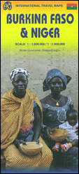
Burkina Faso and Niger on a double-sided, indexed map from ITMB, presenting each country separately at 1:1,000,000 1:1,950,000 respectively and accompanied by street plans of Ouagadougou, Bobo-Dioulasso and Niamey. Altitude colouring shows the topography (with bands in feet in Burkina Faso and in metres in Niger). In Burkina Faso the map indicates areas of periodic inundation, whilst in Niger numerous water wells, salt pans, sand dunes and lava fields are also marked. In both countries parks and nature reserves are highlighted. Road network indicates seasonal roads and shows locations of fuel supplies and border crossings, plus distances on main routes. Airports and aerodromes for small craft are marked; towns are annotated with symbols indicating what facilities can be found there. Each map has latitude and longitude lines (at 1ยฐ in Burkina Faso and 2ยฐ in Niger), plus a separate index.Street plans, annotated with names of hotels, various tourist facilities and main buildings cover Ouagadougou (with an enlargement for the town cente), Bobo-Dioulasso and Niamey.

Related Products:
 Burkina Faso IGN 85020
 Burkina Faso: A History of Power, Protest and Revolution
 Flag of Burkina Faso
 Burkina Faso Bradt Guide
 Nigeria & Niger ITMB
 Mali ITMB
 Niger IGN 85029
 All Aboard for the Bobo Road
 Africa Western ITMB
 Australia ITMB
 Cuba West ITMB
 Sarawak – Sabah – Brunei ITMB
 Cuba ITMB
 Belarus ITMB
 Yukon & Northwest Territories South West ITMB
 Malawi & Mozambique ITMB
 Southern Vietnam – Mekong Delta ITMB
 Togo & Benin ITMB
 Hue – Da Nang & Vietnam Centra ITMB
 Mauritius & Reunion ITMB
 Jakarta ITMB
 Virgin Islands (US and British) ITMB
 Accra & Ghana South ITMB
 Uganda ITMB
 Namibia ITMB
 Cayman Islands & Jamaica ITMB
 Tanzania ITMB
 Rwanda & Burundi ITMB
 Morocco ITMB
 Libya – Tunisia ITMB
 California ITMB
 Santiago & Chile North ITMB
 Albania ITMB
 Colombia ITMB
 Bali & Lombok ITMB
 Angola ITMB
 Alberta ITMB
 Kazakhstan & Uzbekistan ITMB