Disclosure : This site contains affiliate links to products. We may receive a commission for purchases made through these links.
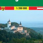
Burgenland

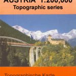
One of the titles in a series of provincial topographic maps derived from generalising the cartography of the 1:50,000 survey. Topography is shown by contours at 100m intervals, spot heights, hill-shading and graphic relief. Colours and graphics distinguish landscape types e.g. forests, vineyards, swamps. The attractive, finely-drawn detail includes minor roads, tracks, railways, chairlifts, water features, national parks, and administrative boundaries. Small symbols show many landmarks e.g. towers, castles, refuges, isolated buildings. Some of the place names are in very small print.The maps have a UTM grid, with latitude lines at intervals of 12` and logintude at 20`. Map legend includes English. Each title also includes a small map with administrative sub-divisions of the province.

Related Products:
 Vorarlberg
Lower Austria
Austria: 200K Topographic Survey Province Maps
Vorarlberg
Lower Austria
Austria: 200K Topographic Survey Province Maps
 Burgenland 2-Map Set Kompass 227
 Burgenland F&B Top 10 Tips
 Pennsylvania Recreation Atlas
 Burgenland F&B
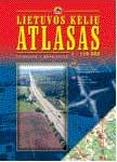 Lithuania Road Atlas
 Kiev Administrative Region
Zaporizhzhia Administrative Region
Zhytomyr Administrative Region
Ternopil Administrative Region
Khmelnytskyi Administrative Region
Lviv Administrative Region
Dnipropetrovsk Administrative Region
Mikolayiv Administrative Region
Rivne Administrative Region
Vinnytsia Administrative Region
Chernihiv Administrative Region
Kharkiv Administrative Region
Cherkasy Administrative Region
Poltava Administrative Region
Kirovohrad Administrative Region
Kherson Administrative Region
Chernivtsi Administrative Region
Sumy Administrative Region
Kiev Administrative Region
Zaporizhzhia Administrative Region
Zhytomyr Administrative Region
Ternopil Administrative Region
Khmelnytskyi Administrative Region
Lviv Administrative Region
Dnipropetrovsk Administrative Region
Mikolayiv Administrative Region
Rivne Administrative Region
Vinnytsia Administrative Region
Chernihiv Administrative Region
Kharkiv Administrative Region
Cherkasy Administrative Region
Poltava Administrative Region
Kirovohrad Administrative Region
Kherson Administrative Region
Chernivtsi Administrative Region
Sumy Administrative Region
 Alaska Reise Know-How
Volynska Oblast Administrative Region
Alaska Reise Know-How
Volynska Oblast Administrative Region
 Zakarpatska Oblast Administrative Region
Ivano-Frankivsk Administrative Region
Zakarpatska Oblast Administrative Region
Ivano-Frankivsk Administrative Region
 Cantabria Autonomous Community CNIG Physical Road Map
 Extremadura Auotomous Community CNIG Physical Road Map
Murcia Autonomous Region 200K CNIG Physical Road Map
Castilla-la-Mancha Autonomous Region 400K CNIG Physical Road Map
Extremadura Auotomous Community CNIG Physical Road Map
Murcia Autonomous Region 200K CNIG Physical Road Map
Castilla-la-Mancha Autonomous Region 400K CNIG Physical Road Map
 Castilla y Leon Autonomous Community CNIG Physical Road Map
 Poland: Reise-Know-How Touring Maps with Historic Place Names
Castilla-La Mancha Autonomous Community CNIG Physical Road Map
Poland: Reise-Know-How Touring Maps with Historic Place Names
Castilla-La Mancha Autonomous Community CNIG Physical Road Map
 Sredna Gora
 Southern Italy – Sardinia – Sicily TCI 400K Road and Tourist Map