Disclosure : This site contains affiliate links to products. We may receive a commission for purchases made through these links.
Budapest Street Atlas
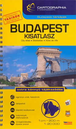
Cartographia’s comprehensive street atlas of Budapest at 1: 20,000 in a spiral-bound format, with an enlargement for the city center, plans of night bus services, plus a comprehensive index of bus routes, tramlines, night services, all rail/metro lines, museums, theatres, libraries, universities, hospitals, embassies, sports facilities, swimming pools/spas and street names.Road classification has five different classes of roads, plus pedestrian only footpaths/zones, cycle tracks, stepped streets and one-way streets. City and district boundaries are clearly marked, as are tramways, trolley-bus routes and terminals, bus lines and terminals, and all metro/rail lines and stations. The maps show built up areas, important buildings, industrial areas, parks, cemeteries, hospitals, police stations, museums, places of worship and other places of interest. Map legend includes English.

Related Products:
 Budapest Pocket Atlas
 Bucharest Street Atlas
 Budapest City Plan
 London Philip`s Mini Street Atlas
 Kolkata / Calcutta Street Atlas
 Lima METRO Street Plan
 Budapest Marco Polo City Map
 Hungary – Budapest Road Atlas SPIRAL-BOUND
 Birmingham A-Z Street Atlas
 Aberdeen A-Z Street Atlas
 Vienna F&B Street Atlas
 Birmingham – Dudley – Solihull – Walsall – Wolverhampton A-Z Big Street Atlas
 Isle of Wight A-Z Street Atlas
 London A-Z Big Street Atlas
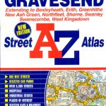 Dartford – Gravesend A-Z Street Atlas
 Weymouth – Dorchester A-Z Street Atlas
 Hastings – Bexhill – St. Leonards – Rye A-Z Street Atlas
 Newcastle upon Tyne A-Z Street Atlas
 Bolton – Bury A-Z Street Atlas
 Southport – Formby – Ormskirk – Skelmersdale A-Z Street Atlas
 Macclesfield – Congleton – Knutsford – Wilmslow A-Z Street Atlas
 Basingstoke- Andover – Overton – Whitchurch A-Z Street Atlas
 Quebec City and Environs Street Atlas
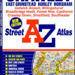 Crawley – East Grinstead – Horley – Horsham A-Z Street Atlas
 Loughborough – Melton Mowbray A-Z Street Atlas
 Winnipeg Pocket Street Atlas
 Chichester – Bognor – Littlehampton – Arundel A-Z Street Atlas
 Bristol – Bath A-Z Street Atlas
 Weston-super-Mare – Burnham-on-Sea – Clevedon A-Z Street Atlas
 Winnipeg and Area Street Atlas
 Bath – Bradford-on-Avon – Trowbridge A-Z Street Atlas
 Kingston upon Hull – Barton-upon-Humber – Beverley A-Z Street Atlas
 Bournemouth – Poole – Christchurch A-Z Street Atlas
 Middlesbrough – Stockton-on-Tees A-Z Street Atlas
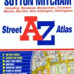 Croydon – Purley – Sutton – Mitcham A-Z Street Atlas
 Bangor – Conwy – Rhyl – Colwyn Bay – Llandudno A-Z Street Atlas
 Montreal Pocket Street Atlas
 Wirral – Birkenhead – Ellesmere Port – Wallasey A-Z Street Atlas
 Burton upon Trent – Ashby-de-la-Zouch – Coalville – Swadlincote A-Z Street Atlas
 Blackburn – Accrington – Burnley A-Z Street Atlas