Disclosure : This site contains affiliate links to products. We may receive a commission for purchases made through these links.
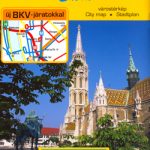
Budapest Marco Polo City Map
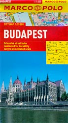
Budapest at 1:15,000 on a pocket-size street plan from Marco Polo Travel Publishing printed on sturdy, waterproof and tear-resistant synthetic paper, with tram and bus routes shown with stops and line numbers, metro stations clearly marked and the lines shown on a separate diagram, lists of useful addresses, etcCoverage extends north beyond the Margit Island, east past the Kincsem Park horse racing track, and east in Buda to the Dรฉli railway station. The plan shows tram and bus routes with stops and line numbers, metro stations, one way streets, car parks and pedestrianized areas. Important buildings and places of interest are marked. Cartography is from the renowned German publishers MairDumont. Multilingual map legend includes English.The index is on the reverse side and includes extensive lists of useful contact details for tourist information offices, hotel reservation, campsites and youth hostels, car hire, museums, emergency services, etc. Also provided is diagram of the city’s metro and rail network, plus a road map of its environs.

Related Products:
 Warsaw Marco Polo City Map
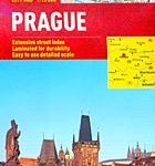 Prague Marco Polo City Map
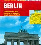 Berlin Marco Polo City Map
 Brussels Marco Polo City Map
 Helsinki City Map
 Istanbul Marco Polo City Map
 Bangkok Marco Polo City Map
 St Petersburg Marco Polo City Map
 Hong Kong Marco Polo City Map
 Budapest City Plan
 Florence Marco Polo City Map
 Rio de Janeiro Marco Polo City Map
 Cape Town Marco Polo City Map
 Boston Marco Polo City Map
 Hungary & Budapest ITMB
 Hungary – Budapest Road Atlas SPIRAL-BOUND
 Innsbruck City Map
 Frankfurt Marco Polo City Map
 Budapest F&B
 Riga City Center Jana Seta Street Plan
 Helsinki & Southern Finland ITMB
 Warsaw & Poland East ITMB
 Zurich & Switzerland NW ITMB
 Hamburg Marco Polo City Map
 Budapest Bicycle Atlas
 Stockholm Borch
 Budapest Classic Plan
 Budapest Comfort Plan
 Helsinki City Map & Guide
 Budapest Cartographia EXTRA Plan
 Munich Marco Polo City Map
 Jurmala Jana Seta Street Plan
 Austria – Liechtenstein – South Tyrol Marco Polo Road Atlas
 Zagreb F&B
 Palma de Mallorca City Map / Mallorca Road Map
 Istanbul & Northwest Turkey ITMB
 Prague F&B
 Tallinn Public Transport Map
 Budapest Borch
 Oslo / Bergen & South of Norway ITMB