Disclosure : This site contains affiliate links to products. We may receive a commission for purchases made through these links.
Buda Hills Atlas
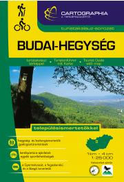
Buda Hills Atlas from the Budapest-based Cartographia with detailed, contoured and GPS compatible mapping at 1:25,000, plus an extensive, Hungarian language guide section providing descriptions of numerous places of interest.The guide has detailed topographic maps at 1:25,000 with contours at 10m intervals enhanced by relief shading, plus colouring and graphics for different types of vegetation and land use, e.g. vineyards, orchards, meadows, woodlands, etc. An overprint highlights local and/or long-distance hiking trails, indicating their waymarking signage. Also marked are recommended cycling routes. Local roads indicate bus routes and stops, and railway lines are shown with stations. Symbols mark various facilities and places of interests including campsites, hostels and other tourist accommodation, restaurants and cafes, etc. The maps have margin ticks with latitude and longitude at 1’ intervals. Map legend includes English.Extensive text, illustrated with colour photos, is in Hungarian only ‘“ a challenge indeed! ‘“ but a lot of useful information, including telephone numbers for tourist offices, can be deciphered with help from a pocket dictionary.To see other titles in this series please click on the series link.

Related Products:
 Buda Hills Cartographia Tourist Map 6
 Matra Mountains Atlas
 Bรผkk Mountains Atlas
 Zemplรฉn Mountains Atlas
 Bรถrzsรถny Mountains Atlas
 Bakony and Somlรณ Mountains Atlas
 Balaton Highlands & Keszthely Mountains Atlas
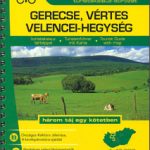 Gerecse – Vertes – Velence Mountains Atlas
 Aggtelek – Gรถmรถr – Torna Karst & Cserehรกt Atlas
 Budapest & the Danube Bend (Pilis – Visegrรกd) Atlas
 Hungarian National Long-distance Blue Trail (E4): Visegrad to Irott-ko
 Gemenc – Szekszard-Hills Tourist Map
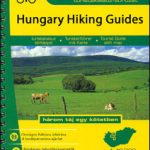
Hungary: Cartographia Hiking Guides
Gemenc – Szekszard-Hills Tourist Map
Hungary: Cartographia Hiking Guides
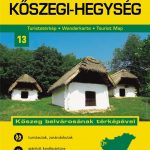 Koszeg Hills Cartographia Tourist Map 13
Hungarian National Long-distance Blue Trail (E7): Irott-ko to Szekszard
Koszeg Hills Cartographia Tourist Map 13
Hungarian National Long-distance Blue Trail (E7): Irott-ko to Szekszard
 Zemplen Hills South Cartographia Tourist Map 23
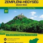 Zemplen Hills North Cartographia Tourist Map 22
Pilis – Visegrad Hills Cartographia Tourist Map 16
Zemplen Hills North Cartographia Tourist Map 22
Pilis – Visegrad Hills Cartographia Tourist Map 16
 Coreen Hills & Glenlivet – Bennachie, Ladder Hills, Insch & Rhynie OS Explorer Map OL62 (paper)
 Coreen Hills & Glenlivet – Bennachie, Ladder Hills, Insch & RhynieOS Explorer Active Map OL62 (waterproof)
 Chitwan: Chepang Hills Trail
 Quantock Hills & Bridgwater OS Explorer Map 140 (paper)
 Dundee & Sidlaw Hills OS Explorer Map 380 (paper)
 Quantock Hills & Bridgwater OS Explorer Active Map 140 (waterproof)
 Dundee & Sidlaw Hills OS Explorer Active Map 380 (waterproof)
 Skye: Cuillin Hills – Soay OS Explorer Map 411 (paper)
 Pentland Hills – Penicuik & West Linton OS Explorer Map 344 (paper)
 Lammermuir Hills – Dalkeith, Bonnyrigg & Gifford OS Explorer Map 345 (paper)
 Skye: Cuillin Hills – Soay OS Explorer Active Map 411 (waterproof)
 Taunton & Blackdown Hills – Wellington & Ilminster OS Explorer Map 128 (paper)
 Lanark & Tinto Hills – Lesmahagow & Douglas OS Explorer Map 335 (paper)
 Pentland Hills – Penicuik & West Linton OS Explorer Active Map 344 (waterproof)
 Lammermuir Hills – Dalkeith, Bonnyrigg & Gifford OS Explorer Active Map 345 (waterproof)
 Lanark & Tinto Hills – Lesmahagow & Douglas OS Explorer Active Map 335 (waterproof)
 Chiltern Hills West – Henley-on-Thames & Wallingford OS Explorer Map 171 (paper)
 Chiltern Hills North: Aylesbury, Berkhamsted & Chesham OS Explorer Map 181 (paper)
 Taunton & Blackdown Hills – Wellington & Ilminster OS Explorer Active Map 128 (waterproof)
 Howardian Hills & Malton – Yorkshire Wolds North OS Explorer Map 300 (paper)
 Lowther Hills, Sanquhar & Leadhills – Wanlockhead & Crawford OS Explorer Map 329 (paper)
 Stirling & Ochil Hills West – Alloa & Dunblane OS Explorer Map 366 (paper)