Disclosure : This site contains affiliate links to products. We may receive a commission for purchases made through these links.
Brough 1908
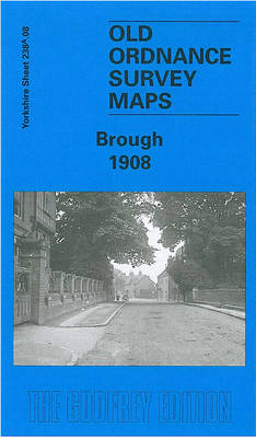
Brough in 1908 in a fascinating series of reproductions of old Ordnance Survey plans in the Alan Godfrey Editions, ideal for anyone interested in the history of their neighbourhood or family. The map covers the village of Brough, originally within the parish of Elloughton. Features include the station, a corn factory, wharf, Skillings Lodge Farm, Brough House, etc. Coverage continues north to the Westfield Park area of Elloughton, and features here include Mill Hill and The Castle, (but the village centre is beyond the map). A small portion of southern Brantingham, around the Roman Road, is also on the map. Directories for Brantingham, Brough and Elloughton are on the reverse.About the Alan Godfrey Editions of the 25″ OS Series:Selected towns in Great Britain and Ireland are covered by maps showing the extent of urban development in the last decades of the 19th and early 20th century. The plans have been taken from the Ordnance Survey mapping and reprinted at about 15 inches to one mile (1:4,340). On the reverse most maps have historical notes and many also include extracts from contemporary directories. Most maps cover about one mile (1.6kms) north/south, one and a half miles (2.4kms) across; adjoining sheets can be combined to provide wider coverage.FOR MORE INFORMATION AND A COMPLETE LIST OF ALL AVAILABLE TITLES PLEASE CLICK ON THE SERIES LINK.

Related Products:
 Knutsford North 1908
 Dun Laoghaire 1908
Knutsford South 1908
Dun Laoghaire 1908
Knutsford South 1908
 Beverley South 1908
 Beverley North 1908
 Sale South-West 1908
Red Rock and Worthington Lakes 1908
Sale South-West 1908
Red Rock and Worthington Lakes 1908
 Tottington 1908
 Hull North East 1908
 Uckfield 1908
Anfield 1908 – 106.07b
Theydon Bois 1915
Uckfield 1908
Anfield 1908 – 106.07b
Theydon Bois 1915
 Bolton North 1908
Wallasey Village 1898
Bolton North 1908
Wallasey Village 1898
 Northwich North East 1908
Lenzie 1897
Northwich North East 1908
Lenzie 1897
 Hull Alexandra Dock 1908
 Bury North 1908
 Altrincham 1908
Bishopbriggs 1910
Ryhope Village 1895
Hull (East) 1908 – 240.03b
Altrincham 1908
Bishopbriggs 1910
Ryhope Village 1895
Hull (East) 1908 – 240.03b
 Rochdale West 1908
 Tong 1905
Dundonald 1902
Tong 1905
Dundonald 1902
 N.W. Leeds 1908 – 218.01b
Pedmore 1921
Southampton (East) 1908 – 65.11a
Wylam and Clara Vale 1895
Wigan West 1908
Dartmoor 1908
Bolton upon Dearne 1901
N.W. Leeds 1908 – 218.01b
Pedmore 1921
Southampton (East) 1908 – 65.11a
Wylam and Clara Vale 1895
Wigan West 1908
Dartmoor 1908
Bolton upon Dearne 1901
 Harrogate 1908
New Quay 1904
Harrogate 1908
New Quay 1904
 Dyserth and Meliden 1910
 Harefield 1935
 Rainhill 1906
Pelton and Urpeth 1895
Rainhill 1906
Pelton and Urpeth 1895
 West Drayton South 1935