Disclosure : This site contains affiliate links to products. We may receive a commission for purchases made through these links.
Brittany – Brest – Rennes K+F Regional Road Map
Brittany on a waterproof and tear-resistant, indexed road map from the Hallwag Kรผmmerly + Frey. To present the whole region at 1:175,000, the map is double-sided, dividing Brittany east/west and presenting it on three panels – on one side coverage along Brittany’s coastline extends from west of St. Malo to Lorient on the southern coast; the rest of the region is on the reverse, shown on two overlapping panels.Road network is shown on a clear base, with colouring indicating regional parks and other protected areas. Scenic routes are highlighted and driving distances are marked on main and connecting secondary routes. Railway lines and ferry connections are included and local airports are marked. A range of small symbols shows various places of interest, including campsites. The map is indexed and has latitude and longitude lines at 10’ intervals. Map legend includes English.

Related Products:
 Denmark South – Kolding – Copenhagen – Bornholm K+F Regional Road Map
 Spain: Mairdumont 300K Regional Road Maps
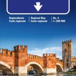
 Emilia-Romagna – Parma – Bologna – Ravenna K+F Regional Road Map 7
 Abruzzo – Molise – l`Aquila – Pescara – Campobasso K+F Regional Road Map 11
 Italy: Kรผmmerly + Frey 200K Regional Road Maps
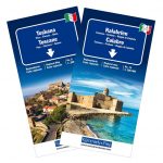
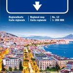 Campania – Basilicata – Naples – Potenza – Bari K+F Regional Road Map 12
 Brittany Wall Map
 Brittany Michelin Regional 512
 Berlin – Brandenburg – Saxony-Anhalt K+F Regional Road Map
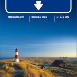 North Sea Coast – Bremen – Hamburg K+F Regional Road Map
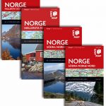 Norway: Norstedts Regional Road Maps
 North Rhine-Westphalia – Cologne – Ruhr Area K+F Regional Road Map
 Wales – South West England – Midlands Michelin Regional 503
 Golden Triangle Road Map – Delhi – Agra – Jaipur
 Midatlantic – Allegheny Highlands Michelin Regional 582
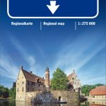
 Bavaria North – Saxony – Thuringia K+F Regional Road Map
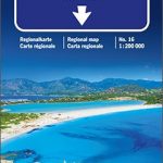 Sardinia – Cagliari – Sassari K+F Regional Map 16
 Sicily – Palermo – Catania K+F Regional Map 15
 Norway: Freytag & Berndt Regional Road Maps
 Poland: Michelin Regional Road Maps
 Great Britain: AA Regional Road Maps
 Germany: Michelin Regional Road Maps
 Italy F&B Great Road Atlas SPIRAL-BOUND
 Chile Compass Road Map
 Veneto – Venice – Verona – Belluno K+F Regional Map 4
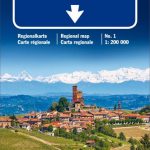 Piedmont – Aosta Valley K+F Regional Map 1
Lombardy – Como – Milan – Brescia K+F Regional Map 2
Piedmont – Aosta Valley K+F Regional Map 1
Lombardy – Como – Milan – Brescia K+F Regional Map 2
 Spain: Michelin Regional Road Maps
 Alpine Roads K+F Road Map
 Liguria – San Remo – Genoa – La Spezia K+F Regional Map 6
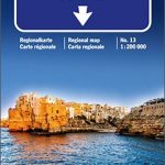 Apulia / Puglia – Foggia – Bari – Lecce K+F Regional Map 13
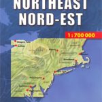 USA North-East
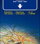 Lazio – Rome – l`Aquila – Gaeta K+F Regional Map 10
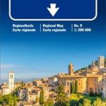 Marches – Umbria – Ancona – Perugia – Terni K+F Regional Map 9
 Germany: Kรผmmerly+Frey 275K Regional Road Map
 Benelux: Michelin Regional Road Maps and Atlases
 New England – Hudson Valley Michelin Regional 581
 Austria: Hallwag K+F 175K Regional Maps
 Italy: Michelin 200K Regional Road Maps
 Friuli-Venezia Giulia – Venice – Udine – Trieste K+F Regional Map 5