Disclosure : This site contains affiliate links to products. We may receive a commission for purchases made through these links.
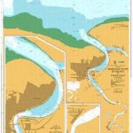
British Columbia ITMB Pocket Road Atlas
75-page, A5 paperback atlas of British Columbia from the Vancouver based ITMB, with street plans of central Vancouver, Victoria and Whistler Village, plus enlargements for the southern tip of the Vancouver Island, the environs of Vancouver and the recreational area around Whistler.The southern half of the province, including most of the Queen Charlotte Islands is shown at 1:925,000, with the remainder of the province at 1:1,250,000. Altitude colouring provides very generalized indication of the topography, with peak names and heights given in some areas. National and provincial parks and protected areas are prominently marked. Numerous camping and RV sites are highlighted, including some in more remote areas for which a more detailed map would be necessary. Symbols indicate recreational areas for hiking, skiing, rafting, etc. as well as various places of interest. The atlas shows the province’s road and rail networks, indicating roads passable only in dry weather or in 4WD vehicle. In remote areas locations petrol stations are marked. Enlargements are provided for the environs of Vancouver (1:185,000) and the southern tip of Vancouver Island (1:250,000). The recreational area around Whistler 1:50,000) shows gondola lines and chair lifts. Also included are plans of Vancouver (the inner districts, plus enlargements for downtown), central Victoria, plus Whistler Village.*PLEASE NOTE:The grid showing how British Columbia is divided between the individual pages of the atlas has no place names, greatly reducing its suitability for visitors unfamiliar with the geography of the province.*

Related Products:
 British Columbia Pocket Road Atlas
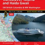 Vancouver Island and Haida Gwaii – SW British Columbia Back Road Atlas
 Canada: ITMB Detailed Road Maps of British Columbia and the Canadian Rockies
 British Columbia ITMB
 British Columbia South ITMB
 British Columbia SW & Washington State ITMB
 British Columbia – Alberta FastTrack
 British Columbia – Alberta MapArt
 British Columbia FastTrack
 British Columbia MapArt Road Atlas
 Western & Northern Canada ITMB Travel Atlas
 Haida Gwaii / Queen Charlotte Islands – British Columbia Coast ITMB
 Moon British Columbia: Including the Alaska Highway
 Ontario MapArt Pocket Road Atlas
 Vancouver and Area Pocket Street Atlas
 100 Nature Hot Spots in British Columbia: The Best Parks, Conservation Areas and Wild Places
 British Columbia MapArt
 Alaska – Dempster and Dalton Highways ITMB Road Atlas
 Hungary Pocket Road Atlas SPIRAL-BOUND
 Lonely Planet British Columbia & the Canadian Rockies
 Southern British Columbia & Alberta ITMB
 Quebec & Ontario ITMB Travel Atlas
Quebec Province Pocket Road Atlas
Quebec & Ontario ITMB Travel Atlas
Quebec Province Pocket Road Atlas
 Fraser Valley and Vancouver ITMB
 Vancouver Island MapArt Street Atlas
 Southwest British Columbia & Northern Washington Gem Trek
Finland Karttakeskus Road Atlas
Sunshine Coast – British Columbia Southwest ITMB
Southwest British Columbia & Northern Washington Gem Trek
Finland Karttakeskus Road Atlas
Sunshine Coast – British Columbia Southwest ITMB
 Route 66 “The Mother Road” ITMB Road Atlas
 Alberta Pocket Road Atlas
 Vancouver`s Northshore Hiking Trails ITMB
 Japan Railway & Road ITMB Travel Atlas
 Whistler and Sea-to-Sky Highway ITMB
 USA: Antenna Audio American Highway Road Atlas – A4, PAPERBACK
 Latvia Jana Seta Road Atlas
 USA: Antenna Audio American Highway Road Atlas – A3, PAPERBACK
 Canada: ITMB/Canada Map Office Topographic Maps of British Columbia and the Rockies
 Southwest Alberta & Southeast British Columbia Gem Trek
 Eastern Canada ITMB Travel Atlas
 Vancouver to Calgary MapArt Back Road Atlas