Disclosure : This site contains affiliate links to products. We may receive a commission for purchases made through these links.
Bristol: Bartholomew`s Street Plan c.1870 MEDIUM
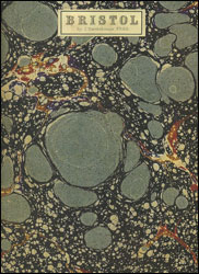
Cloth-backed reproduction (medium size) by the Old Folding Maps company of a street plan of Bristol drawn by J. Batholomew around 1870. Locations of 15 significant buildings including the Philosophical Institution, the Assembly Rooms, the Exchange, etc. and highlighted on the plan and cross-referenced to the accompanying list. Coverage extends north to Cotham and Montpellier, with the Clifton Suspension Bridge opened in 1864 in the north-western corner, south across the Avon to include Bedminster, and east to Upper Easton. Hachures are used to show Brandon Hill and the banks of the Avon either side of the Suspension Bridge.Each individual cloth-backed map is sold folded in a colourful case covered with a unique design marbled paper ‘“ no two cases are identical.PLEASE NOTE: this title is also available in a smaller size. To see the list of all the titles in this series from the Old Folding Maps please click on the series link.

Related Products:
 Bristol: Bartholomew`s Street Plan c.1870 SMALL
 London: Lewis` Topographical Dictionary Plan 1840 MEDIUM
 Paris: Plan de Paris c.1818 MEDIUM
 Paris: Plan de Paris et ses Fortifications c.1844 MEDIUM
 France: Cruchley`s Map for Schools and Families c.1842 MEDIUM
World Regions c. 1890 MEDIUM
France: Cruchley`s Map for Schools and Families c.1842 MEDIUM
World Regions c. 1890 MEDIUM
 England and Wales: Brookes` Travelling Companion Map MEDIUM
 World on Mercator`s Projection by James Wyld c.1861 MEDIUM
Paris: Plan de Paris c.1818 SMALL
London: Rocque London c. 1741-5 MEDIUM
World on Mercator`s Projection by James Wyld c.1861 MEDIUM
Paris: Plan de Paris c.1818 SMALL
London: Rocque London c. 1741-5 MEDIUM
 Paris: Plan de Paris et ses Fortifications c.1844 SMALL
London: Vicinity of London c.1847 MEDIUM
Paris: Plan de Paris et ses Fortifications c.1844 SMALL
London: Vicinity of London c.1847 MEDIUM
 Africa c.1880 MEDIUM
Basin Of The Mediterranean Map MEDIUM
Australia c. 1895 MEDIUM
Africa c.1880 MEDIUM
Basin Of The Mediterranean Map MEDIUM
Australia c. 1895 MEDIUM
 London: Cruchley`s 12 Miles Round London c.1826 MEDIUM
 Italy: Stanfords Map of Italy 1859 MEDIUM
United Kingdom Steam Navigation Map MEDIUM
Italy: Stanfords Map of Italy 1859 MEDIUM
United Kingdom Steam Navigation Map MEDIUM
 Africa: Gall & Inglis Map c.1854 MEDIUM
Farther India MEDIUM
Africa: Gall & Inglis Map c.1854 MEDIUM
Farther India MEDIUM
 Australian Colonies and New Zealand c.1874 MEDIUM
 London: A New Map of London by Robert Laurie & James Whittle c.1800 MEDIUM
London: Edward Mogg`s 24 Miles c. 1851 MEDIUM
London: A New Map of London by Robert Laurie & James Whittle c.1800 MEDIUM
London: Edward Mogg`s 24 Miles c. 1851 MEDIUM
 Palestine or the Holy Land c.1818 MEDIUM
North Polar Chart 1902 MEDIUM
Palestine or the Holy Land c.1818 MEDIUM
North Polar Chart 1902 MEDIUM
 Bristol 1872
London: Froggets 30 miles round London MEDIUM
Bristol 1872
London: Froggets 30 miles round London MEDIUM
 Europe: Cruchley`s New Map of Europe c.1860 MEDIUM
 London: Robert Sayer`s London Directory Map 1792 MEDIUM
 Europe: An Accurate Map of Europe in 1755 MEDIUM
 India c.1838 MEDIUM
 London: Daniel Paterson`s 24 Miles Round London with Seats of Gentry and Nobility c.1791 MEDIUM
 China c. May, 1828 MEDIUM
Russia c. 1895 MEDIUM
British Isles Geological MEDIUM
China c. May, 1828 MEDIUM
Russia c. 1895 MEDIUM
British Isles Geological MEDIUM
 Cruchley`s London 1832
 London: Urbium Londini et West Monasterii c.1736 MEDIUM
 Ireland: A New Map by William Faden c.1797 MEDIUM
 St. Petersburg Jana Seta Street Plan
 Bristol (NE) 1902 – 72.13a