Brunico/Bruneck – Plan de Corones/Kronplatz area at 1:25,000 on a durable, waterproof and tear-resistant map from Kompass in their series of detailed maps of the Dolomites.CARTOGRAPHY: Read More »
Malhamdale (24 walks) is the Hillside mini guide to walking 24 concisely described routes of between 4.5 and 9.5 miles in the Malhamdale area of the Read More »
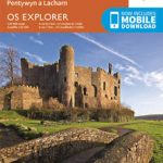
Carmarthen, Kidwelly, Pendine and Laugharne area on a detailed topographic and GPS compatible map No. 177, paper version, from the Ordnance Survey’s 1:25,000 Explorer series.MOBILE DOWNLOADS: Read More »
Topographic survey of France at 1:25,000 in IGN`s excellent TOP25 / Sรฉrie Bleue series. All the maps are GPS compatible, with a 1km UTM grid plus Read More »
Waterproof and tear-resistant OS Active version of map No. 114 from the Ordnance Survey’s Landranger series at 1:50,000, with contoured and GPS compatible topographic mapping plus Read More »
Topographic coverage of mainland Spain at 1:50,000 in the MTN50 (Mapa Topogrรกfico Nacional) series from the Centro Nacional de Informaciรณn Geografica, the country’s civilian survey organization. Read More »
This is a stunning new edition of the classic African story collection, by Nobel-Prize winner Doris Lessing. In this superb volume of African stories, Doris Lessing Read More »
William Stoner enters the University of Missouri at nineteen to study agriculture. A seminar on English literature changes his life, and he never returns to work Read More »
Cloth-backed reproduction of a map published by James Wyld in 1828 covering not just Sweden and Norway but also the rest of the Baltic Sea basin Read More »