Disclosure : This site contains affiliate links to products. We may receive a commission for purchases made through these links.
Brazil NGS Executive Wall Map PAPER
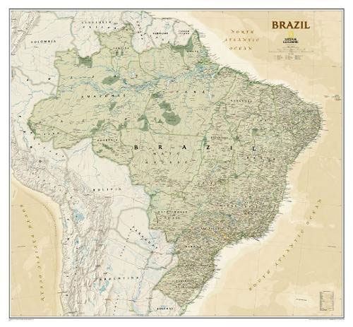
Brazil at 1:5,000,000 on a large wall map, paper version, in the National Geographic Society’s Executive style which offers current information presented in elegant antique style of muted shades of beige, with internal state boundaries outlined in green.The base map has subtle relief shading, with names of mountain ranges and spot heights in metres. Graphics show main swamp regions and colouring highlights national parks and other protected areas. Numerous rivers are named, particularly within the Amazon Basin. The map shows the country’s road network, including the Trans-Amazon Highway; main railway lines and local airports are also included.Internal administrative boundaries and names of the states are clearly marked. The map has latitude and longitude lines at intervals of 6ยฐ.* This wall map is also available encapsulated.

Related Products:
 Brazil NGS Executive Wall Map ENCAPSULATED
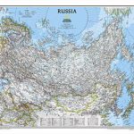 Russia NGS Classic Wall Map PAPER
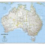
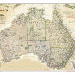 Australia NGS Executive Wall Map PAPER
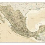
 Mexico NGS Executive Wall Map PAPER
 North America NGS Executive Wall Map PAPER
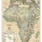
 Africa NGS Executive Wall Map PAPER
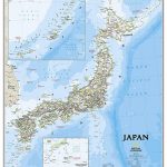
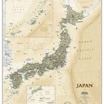 Japan NGS Executive Wall Map PAPER
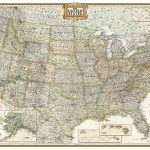
 United States NGS Executive Wall Map PAPER
Brazil Reise Know-How
United States NGS Executive Wall Map PAPER
Brazil Reise Know-How
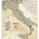 Italy NGS Executive Wall Map PAPER
 Canada NGS Executive Wall Map PAPER
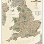 England and Wales NGS Executive Wall Map PAPER
 Asia NGS Executive Wall Map PAPER
 Brazil F&B
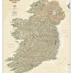 Ireland NGS Executive Wall Map PAPER
 South America NGS Executive Wall Map ENCAPSULATED
 Germany NGS Executive Wall Map PAPER
 Europe NGS Executive Wall Map PAPER
Amazon & Brazil North ITMB
Europe NGS Executive Wall Map PAPER
Amazon & Brazil North ITMB
 United States NGS Executive Wall Map LARGE PAPER
 South America Global Mapping Political Wall Map PAPER
 Europe NGS Executive Wall Map LARGE PAPER
Africa NGS Classic Wall Map PAPER
Europe NGS Executive Wall Map LARGE PAPER
Africa NGS Classic Wall Map PAPER
 Australia NGS Classic Wall Map PAPER
 Africa NGS Classic Wall Map LARGE PAPER
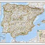 Spain and Portugal NGS Classic Wall Map PAPER
 Japan NGS Classic Wall Map PAPER
 Britain and Ireland NGS Executive Wall Map PAPER
 France, Belgium and Netherlands NGS Executive Wall Map PAPER
 World NGS Explorer Executive Wall Map PAPER
 Canada NGS Executive Wall Map ENCAPSULATED
 Balkans NGS Classic Wall Map PAPER
 Brazil – Bolivia – Paraguay – Uruguay Marco Polo Map
 China NGS Classic Wall Map PAPER
 Mexico NGS Executive Wall Map ENCAPSULATED
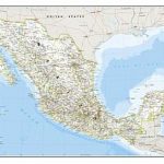 Mexico NGS Classic Wall Map PAPER
 North America NGS Classic Wall Map PAPER
 Africa NGS Executive Wall Map ENCAPSULATED
 Central America NGS Classic Wall Map PAPER
 Canada NGS Classic Wall Map PAPER