Disclosure : This site contains affiliate links to products. We may receive a commission for purchases made through these links.
Bradford North 1906
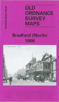
Bradford North in 1906 in a fascinating series of reproductions of old Ordnance Survey plans in the Alan Godfrey Editions, ideal for anyone interested in the history of their neighbourhood or family. The map covers the northern part of central Bradford, including the eastern part of Manningham. Coverage stretches from Salt Street eastward to Undercliffe Street and from the Midland (Forster Sq) station northward to Queen`s Road and Clifton Villas. Features include the railway approaches to the Midland station, including full track layout, turntable, goods shed, sidings etc; much of Peel Park; Cliffe Wood & Spinkwell Quarries, Otley Road, Bolton Road, Hill Side Villas, Bradford Cemetery, Sunnybank Laundry, Wapping, Bradford Canal with wharf and warehouses, Manningham Lane, Infirmary, Lumb Lane Mills, Clifton Villas, Valley Mills, Valley Road Gas Works, tramways, Valley Parade and football ground. On the reverse are street directory entries for Bolton Road and Manningham Lane.About the Alan Godfrey Editions of the 25″ OS Series:Selected towns in Great Britain and Ireland are covered by maps showing the extent of urban development in the last decades of the 19th and early 20th century. The plans have been taken from the Ordnance Survey mapping and reprinted at about 15 inches to one mile (1:4,340). On the reverse most maps have historical notes and many also include extracts from contemporary directories. Most maps cover about one mile (1.6kms) north/south, one and a half miles (2.4kms) across; adjoining sheets can be combined to provide wider coverage.FOR MORE INFORMATION AND A COMPLETE LIST OF ALL AVAILABLE TITLES PLEASE CLICK ON THE SERIES LINK.

Related Products:
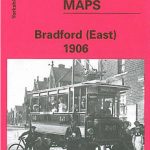 Bradford East 1906
 Bradford Central 1906
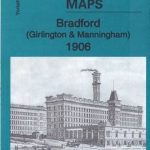 Bradford (Girlington & Manningham) 1906: Yorkshire Sheet 216.03
 Bolton North 1908
 Leeds South and South East 1906
 Liverpool North 1906
 Aintree 1906
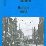 Bolton 1908 – 87.13b
 Hurst and North Ashton 1906
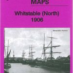 Whitstable (North) 1906 – 23.10
 Holbeck & New Wortley 1906 – 218.05b
 Keighley North 1913
 Bradford Odsal & Low Moor 1905
Bolton South and Great Lever 1927
Bradford Odsal & Low Moor 1905
Bolton South and Great Lever 1927
 Peebles 1906 – 13.06
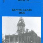 Central Leeds 1906 – 218.02b
Penryn 1906
Central Leeds 1906 – 218.02b
Penryn 1906
 Walton on the Hill 1906
 Kirkdale 1906
Bamfurlong and Bryn Gates 1906
Kirkdale 1906
Bamfurlong and Bryn Gates 1906
 Leeds East 1906
 Liverpool Toxteth 1906
Leeds Central and North East 1890
Leicester North West 1902
Liverpool Toxteth 1906
Leeds Central and North East 1890
Leicester North West 1902
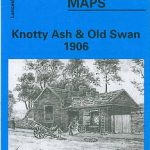 Knotty Ash and Old Swan 1906
Stockton (North) 1899 – 50.12a
Knotty Ash and Old Swan 1906
Stockton (North) 1899 – 50.12a
 Hull North East 1908
 Bromley North and Sundridge Park 1895
 Derby (South) 1899 – 50.13a
Leicester (NE) 1913 – 31.11
North Shields and Chirton 1894
Lostock Hall and Farington North 1909
Redruth 1906
Leeds South and South East 1890 (Colour Edition)
Norwich (North) 1905 – 63.11
Derby (South) 1899 – 50.13a
Leicester (NE) 1913 – 31.11
North Shields and Chirton 1894
Lostock Hall and Farington North 1909
Redruth 1906
Leeds South and South East 1890 (Colour Edition)
Norwich (North) 1905 – 63.11
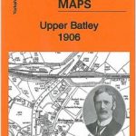 Upper Batley 1906
Plymouth North 1893
Belfast North 1920
Upper Batley 1906
Plymouth North 1893
Belfast North 1920
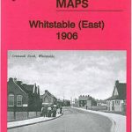 Whitstable East 1906
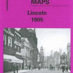 City of Lincoln 1905 – 70.07a