Disclosure : This site contains affiliate links to products. We may receive a commission for purchases made through these links.
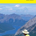
Bow Lake & Saskatchewan Crossing Gem Trek Map
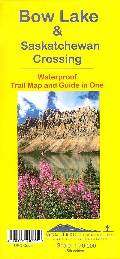
Bow Lake – Saskatchewan Crossing region of the Canadian Rockies on a contoured and GPS compatible map at 1:70,000 from Gem Trek with an extension at 1:100,000 to include the Mosquito Creek ‘“ Fish Lakes area, plus extensive tourist information on recommended hikes, etc.The map shows trails departing from the southern section of the Icefields Parkway, from Rampart Creek south to Hector Lake. This is prime hiking terrain with scenery as superb as the rest of Banff National Park, but with the trails less busy than those in the Banff village and Lake Louise areas. Contours interval is 50m, without relief shading but with colouring for forests and glaciers. The map has a 1km UTM grid and margin ticks at 5’. On the reverse are trail descriptions and photos of 16 recommended day hikes, ranging from short and easy to long and strenuous, as well as descriptions of five overnight trips. Classic trails covered include Bow Glacier Falls, Helen Lake, Bow Summit Lookout, Sunset Pass, and Cirque, Chephren and Glacier Lake trails. Contact numbers for parks and information on lodges, campgrounds and hostels in the area are included. Also provided are descriptions of the Mosquito Creek – Fish Lakes area shown on the inset.To see the list of titles in this series please click on the series link.

Related Products:
 Best of Lake Louise Gem Trek
 Banff – Egypt Lake Gem Trek
 Kananaskis Lakes Gem Trek
 Jasper & Maligne Lake Gem Trek
 Highwood & Cataract Creek – Kananaskis Country Gem Trek Map
 Banff & Mount Assiniboine Gem Trek
 Canmore and Kananaskis Village Gem Trek
 Waterton Lakes National Park Gem Trek Map
 Banff Up-Close Gem Trek
 Best of Canmore Gem Trek
 Lake O`Hara Gem Trek Map
 Columbia Icefield Gem Trek Map
 Canadian Rockies – Banff – Jasper – Yoho Gem Trek Map
 Gosainkunda – Trek to Shiva`s Sacred Lake
 Best of Jasper Gem Trek
Canada: Gem Trek Hiking Maps of the Banff & Jasper National Parks & the Canadian Rockies
Best of Jasper Gem Trek
Canada: Gem Trek Hiking Maps of the Banff & Jasper National Parks & the Canadian Rockies
 Lake District: Low Level and Lake Walks
 Kootenay National Park Gem Trek Map
 Lake Maggiore – Lake Orta – Lake Varese K+F Outdoor Map 8
 Iceland Hikes – with Reykjavik City Guide: 11 selected trails including 1- to 3-day hikes and the Laugavegur Trek
 Lake Tahoe Basin Trail Map
 St Anna Lake Dimap Hiking Map
 Northern Agrafa – Plastira Lake Anavasi 4.1
 Royal Trek
 Moon Best of Glacier, Banff & Jasper (First Edition): Make the Most of One to Three Days in the Parks
 Banff National Park Gem Trek
 Lake Maggiore – Lake Varese Kompass 90
 Dunai to Jumla and Rara Lake
 Lake Garda – Lake Idro – Monte Baldo – Verona K+F Outdoor Map 7
 Tilicho Hidden Lake
 Lake Como – Lake Lugano Kompass 91
 Fish Lake – Manti UT
 The Trabant Trek – Crossing the World in a Plastic Car
 NOAA Chart 11495 – St. Johns River’”Dunns Creek to Lake Dexter
 Lake District Mountain Biking – Essential Trails
 NOAA Chart 18447 – Lake Washington Ship Canal and Lake Washington – Lake Washington Ship Canal – Lake Washington
 Lake District A-Z Adventure Atlas
 Guerrilla Trek – Dhorpatan Hunting Reserve
 CEN305E Lake Huron, St. Marys River, Lake Superior, 2000 – CHS Sailing Directions
 Lonely Planet Banff, Jasper and Glacier National Parks