Disclosure : This site contains affiliate links to products. We may receive a commission for purchases made through these links.
Categories
-
Best Sellers
-
Weser Cycle Route – Hann Hann – Munden – Cuxhaven Publicpress Cycle Touring 256
-

Doulevant-le-Chรขteau – Soulaines-Dhuys IGN 3017SB
Topographic survey of France at 1:25,000 in IGN`s excellent TOP25 / Sรฉrie Bleue series. All the maps are GPS compatible, with a 1km UTM grid plus Read More » -
Gunnislake South and Albaston 1905
Gunnislake South and Albaston in 1905 in a fascinating series of reproductions of old Ordnance Survey plans in the Alan Godfrey Editions, ideal for anyone interested Read More » -

Admiralty Chart 2538 – Malta
NEW EDITION OUT ON 03/12/2020Admiralty standard nautical charts comply with Safety of Life at Sea (SOLAS) regulations and are ideal for professional, commercial and recreational use. Read More » -

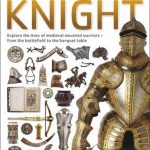
Knight
This book includes a spectacular and engaging non-fiction eyewitness guide to the most revered noblemen in history, “Knights”. How did you become a “Knight”? When would Read More » -

The Black Album
Shahid is a clean-cut student, trying to make an impression on his college lecturer, Deedee Osgood, who gives his spirits a lift when she takes him Read More » -

The Murderer of Warren Street: The True Story of a Nineteenth-Century Revolutionary
`A Victorian whodunit… Swashbuckling adventure and political thriller… A magnificent book.` Francis Wheen, The Oldie In December 1854, Emmanuel Barthelemy visited 73 Warren Street in the Read More » -

The Second Sleep: the Sunday Times #1 bestselling novel
THE LATEST NOVEL FROM ROBERT HARRIS: chosen as a Book of the Year by The Times, Sunday Times, Guardian, Telegraph, Mail on Sunday, and ExpressWHAT IF Read More » -

Insight Guides Pocket Jersey
From the quaint capital of Saint Helier, to the wealth of hidden coves and beaches, to the maze of craggy coastal walks, Jersey has much to Read More » -

Rommaeno
The 1:50 000 topographic map gives a more general picture of the ground features than a basic map. It shows settlements, houses, roads, cultivated areas, waterways, Read More »
-


