Disclosure : This site contains affiliate links to products. We may receive a commission for purchases made through these links.
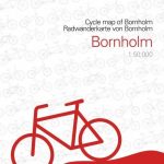
Bornholm Kompass 236

The Baltic island of Bornholm at 1:50,000 on a contoured and GPS compatible map from Kompass, printed on sturdy, waterproof and tear-resistant synthetic paper, with additional insets showing a street plan of Rรธnne plus the Ertholmene (Christiansรธ) archipelago.The map has contours at 10m intervals, with colouring indicating woodlands. An overprint highlights hiking trails and cycling routes, including the tour around the island. Symbols indicate various types of tourist accommodation, sport and recreational facilities and places of interest. Also marked are ferry connections to Denmark and other Baltic ports. The map has a 2km UTM grid. Map legend includes English. Insets show the nearby the Ertholmene (Christiansรธ) archipelago at 1:30,000, plus a street plan of Rรธnne, both annotated with facilities and/or places of interest.PLEASE NOTE: the map comes with a German language booklet about the island, with includes descriptions of interesting locations, recommendations for cycling excursions, etc. The booklet is not available in an English version. The legend for the map, as stated above, does include English.


