Disclosure : This site contains affiliate links to products. We may receive a commission for purchases made through these links.
Borneo, Java, Sumatra, & the Philippine Islands c.1900

Related Products:
 NP33 Philippine Islands Pilot SUPERCEDED
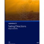 NP33 Philippine Islands Pilot 2021
 NP33 Philippine Islands Pilot – Digital
 NGA Chart 92006 – Philippine Islands – Southern Part
 Admiralty Chart 2914 – Plans in the Philippine Islands
 Admiralty Chart 4446 – Philippine Islands – Sulu Archipelago
 Admiralty Chart 4507 – Philippine Islands to Bismark Archipelago
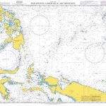
 Admiralty Chart Folio 58 – E Sulawesi to Western New Guinea – Southeastern Part of Philippine Islands
 New Zealand, Tasmania, Sandwich Islands, & Fiji c.1900
Northern Scotland, Orkney & Shetlands Islands, and the Hebrides c.1900
New Zealand, Tasmania, Sandwich Islands, & Fiji c.1900
Northern Scotland, Orkney & Shetlands Islands, and the Hebrides c.1900
 Sumatra ITMB
 Sumatra Reise-Know-How Map
 Sumatra – Medan Periplus Travel Map
 Java ITMB
 Java – Jakarta F&B
 Java Reise Know-How
 Borneo Reise Know-How
 Java – Jakarta Nelles
 NGA Chart 72000 – Java Sea
 Borneo / Kalimantan ITMB
 Java & Bali Periplus Travel Map
 Where Hornbills Fly: A Journey with the Headhunters of Borneo
 NGA Chart 72028 – Central Portion of Java
 NGA Chart 72035 – Eastern Portion of Java
 Pocket Photo Guide to the Birds of Borneo
 A Naturalist`s Guide to the Birds of Borneo (3rd edition)
 Mataram: A novel of love, faith and power in early Java
 NGA Chart 71033 – W. Part Java Sea, SO Passages to China
 Phillipps Field Guide to the Mammals of Borneo (2nd edition)
 Borneo – Malaysia East – Brunei – Kalimantan Nelles
 NGA Chart 72021 – Java Sea (Eastern Part) Incl. Makassar
 Playing With Water: Alone on a Philippine Island
 Photographic Guide to the Birds of Southeast Asia: Including the Philippines and Borneo
 On The Java Ridge
 Into the Heart of Borneo
 Enchanting Borneo
 Fever Trees of Borneo
 Borneo Culture Shock!
 Borneo Bradt Guide
 Lonely Planet Borneo