Disclosure : This site contains affiliate links to products. We may receive a commission for purchases made through these links.
Blur Ridge Parkway Southern Section
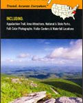
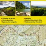
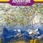
The northern section of the Blue Ridge Parkway and the surrounding area of the Appalachian Mountains on a double-sided map at 1:135,000 approx. from Outdoor Paths Publishing highlighting facilities along the route. The map covers the first part of the Parkway, from Milepost 0 to 123.Topography of the area is shown by relief shading based on the satellite imagery, with names and heights of numerous peaks and icons highlighting waterfalls. Boundaries of the Blue Ridge Parkway lands and other public lands are marked. The route is annotated with mile posts and shows access to the Parkway from the adjoining roads, gates and view points. Icons indicate campgrounds, picnic areas, restaurants and visitor centres. Also marked are locations of trailheads along the routes ‘“ the staring points for local walks ‘“ with a separate list indicating their length and the degree of difficulty. The map also shows the route of the Appalachian Trail long-distance footpath which roughly follows the course of the Blue Ridge Parkway and crosses it in several places. The map is not indexed and does not have geographical coordinates for GPS.About the Blue Ridge Parkway (courtesy of the Wikipedia):The Blue Ridge Parkway is a National Parkway and All-American Road in the United States, noted for its scenic beauty. It runs for 469 miles (755 km), mostly along the famous Blue Ridge, a major mountain chain that is part of the Appalachian Mountains. Its southern terminus is on the boundary between Great Smoky Mountains National Park and the Cherokee Indian Reservation in North Carolina, from which it travels north to Shenandoah National Park in Virginia and offers access to the Skyline Drive, the major north/south artery through the Park. The two All-American Byways are separate and distinct. The Blue Ridge Parkway was built to connect Shenandoah National Park to the Great Smoky Mountains National Park.The Parkway is not a National Park, but is a National Scenic Byway and All-American Road, and is the most visited unit in the United States National Park System. Land on either side of the road is maintained by the National Park Service and, in many places, the park is bordered by land protected by the United States Forest Service. The Parkway will be depicted on North Carolina`s version of the America the Beautiful quarter in 2015


