Disclosure : This site contains affiliate links to products. We may receive a commission for purchases made through these links.
Bled Pocket Map
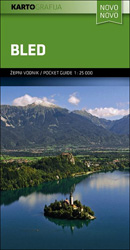
Bled and its lake in the Julian Alps at 1:25,000 on a contoured, GPS compatible pocket map from Kartografija highlighting hiking and cycling trails, plus extensive notes about the area and its sights, lists of tourist accommodation, recommendations for restaurants and tavernas, etc.Kartografija’s pocket hiking maps at 1:25,000 show walking trails and cycling routes, along with numerous tourist facilities and recreational sites. Topography is shown by contours at 20m intervals enhanced by relief shading and graphic relief to show exposed rocky areas, plus colouring for woodlands. Hiking trails and cycling routes are prominently highlighted, and symbols indicate locations of various accommodation options including campsites and mountain huts, sport and recreational sites and facilities, natural features of particular interest, etc. The maps have a grid with latitude and longitude lines at 1’ intervals. Map legend includes English.On the reverse each map has extensive bilingual Slovenian/English text with more tourist information, illustrated with colour photos.To see the list of all the titles in this series please click on the series link.

Related Products:
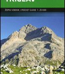 Triglav Pocket Map
 ล marna Gora – Raลกica Pocket Map
 Kurhessisches Bergland
 Mรกtra Cartographia Tourist Map 14
 Zselic Cartographia Tourist Map 17
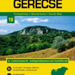 Gerecse Cartographia Tourist Map 10
 Borzsony Cartographia Tourist Map 5
 Bรผkk Cartographia Tourist Map 29
 Vรฉrtes Cartographia Tourist Map 20
 Korรงa and Environs
 Puka and Environs
 Elbasan – Berat
 Saranda and Environs
 Gemenc – Szekszard-Hills Tourist Map
 Buda Hills Cartographia Tourist Map 6
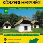 Koszeg Hills Cartographia Tourist Map 13
 Orsรฉg – Gรถcsej – Kemeneshat Cartographia Tourist Map 21
 Vlora and Environs
 Tirana – Durrรซs – Kruja
 Mecsek – Villรกny Mountains Cartographia Tourist Map 15
 Cserhat – Karancs – Medves Cartographia Tourist Map 8
 Zemplen Hills South Cartographia Tourist Map 23
 Zemplen Hills North Cartographia Tourist Map 22
Pilis – Visegrad Hills Cartographia Tourist Map 16
Zemplen Hills North Cartographia Tourist Map 22
Pilis – Visegrad Hills Cartographia Tourist Map 16
 Gรถmรถr – Tornai-Karszt – Cserehรกt Cartographia Tourist Map 1
Szigetkoz – Tokoz – Czilizkoz
Gรถmรถr – Tornai-Karszt – Cserehรกt Cartographia Tourist Map 1
Szigetkoz – Tokoz – Czilizkoz
 Lake Balaton Cartographia Tourist Map 4
 Danube Bend Cartographia Tourist Map 31
Hungary: Cartographia Hiking Maps
Danube Bend Cartographia Tourist Map 31
Hungary: Cartographia Hiking Maps
 Heilbronn
 Gรถppingen
Pforzheim
Offenburg
Lรถrrach
Singer
Bad Urach
Sigmaringen
Bad Saulgau
Gรถppingen
Pforzheim
Offenburg
Lรถrrach
Singer
Bad Urach
Sigmaringen
Bad Saulgau