Disclosure : This site contains affiliate links to products. We may receive a commission for purchases made through these links.
Blackburn West 1929

Blackburn West in 1929 in a fascinating series of reproductions of old Ordnance Survey plans in the Alan Godfrey Editions, ideal for anyone interested in the history of their neighbourhood or family. The map covers the western part of Blackburn, stretching from Montague Street and Leyland Street westward to Billinge Nook and Billinge Hill, and from Wycollard Road southward to Redlam Brow. Much of Witton Park is included on the map (but not the house). Features include Preston New Road, Wensley Fold, St Mark`s church, Cross Hill school, Springfield Maternity Home, Billinge End, Garden Street Mill, Bank Top Mill, Corporation Park, Johnston Street Mill, Peel Mill, St Paul`s Ward, The Wrangling, Belle Vue Mill, Alexandra Meadows, many other mills, tramways, River Blakewater, etc. On the reverse are extracts from a 1918 directory including street entries for Bank Top, Dukes Brow, Granville Road, Leamington Road, Preston New Road, Redlam, Revidge Road and West Park Road. About the Alan Godfrey Editions of the 25″ OS Series:Selected towns in Great Britain and Ireland are covered by maps showing the extent of urban development in the last decades of the 19th and early 20th century. The plans have been taken from the Ordnance Survey mapping and reprinted at about 15 inches to one mile (1:4,340). On the reverse most maps have historical notes and many also include extracts from contemporary directories. Most maps cover about one mile (1.6kms) north/south, one and a half miles (2.4kms) across; adjoining sheets can be combined to provide wider coverage.FOR MORE INFORMATION AND A COMPLETE LIST OF ALL AVAILABLE TITLES PLEASE CLICK ON THE SERIES LINK.

Related Products:
 Blackburn 1929
Blackburn 1910
Blackburn 1929
Blackburn 1910
 Blackburn 1892 (Coloured Edition)
 Rochdale West 1908
Sheffield (West) 1903 – 294.07b
Rochdale West 1908
Sheffield (West) 1903 – 294.07b
 Darlington West 1898
Bow, Bromley & West Ham 1867 – 53.1
Darlington West 1898
Bow, Bromley & West Ham 1867 – 53.1
 West Pennine Moors – Blackburn, Darwen & Accrington OS Explorer Map 287 (paper)
Manchester North West and Central Salford 1915
Doncaster North 1929
West Twickenham & Strawberry Hill 1894 – 121a
West Pennine Moors – Blackburn, Darwen & Accrington OS Explorer Map 287 (paper)
Manchester North West and Central Salford 1915
Doncaster North 1929
West Twickenham & Strawberry Hill 1894 – 121a
 Hull West 1928
 West Twickenham & Strawberry Hill 1934 – 121b
 Bolton North 1908
Dundee West 1901
Hull West 1890 (Colour Edition)
Carlisle South-West 1924
Bolton North 1908
Dundee West 1901
Hull West 1890 (Colour Edition)
Carlisle South-West 1924
 West Pennine Moors – Blackburn, Darwen & Accrington OS Explorer Active Map 287 (waterproof)
Bangor West 1901
West Pennine Moors – Blackburn, Darwen & Accrington OS Explorer Active Map 287 (waterproof)
Bangor West 1901
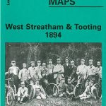 West Streatham & Tooting 1894 – 135a
Oswaldtwistle and Church 1909
West Streatham & Tooting 1894 – 135a
Oswaldtwistle and Church 1909
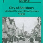 City of Salisbury with West Harnham & East Harnham 1900 – 66.15
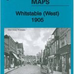 Whitstable West 1905
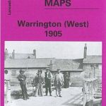 Warrington West 1905
Great Malvern and West Malvern 1926
Wolverhampton North West 1901
Worcester South-West 1902
Warrington West 1905
Great Malvern and West Malvern 1926
Wolverhampton North West 1901
Worcester South-West 1902
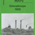 Grimethorpe 1929
 Blackburn – Accrington – Burnley A-Z Street Atlas
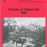 Finchley and Holders Hill 1895
Maldon West 1920 – 55.16
Finchley and Holders Hill 1895
Maldon West 1920 – 55.16
 St Albans South-West 1897
Rutherglen West and Polmadie 1910
St Albans South-West 1897
Rutherglen West and Polmadie 1910
 Heywood 1907
Ipswich South-West 1902
Worcester North-West 1902
Walthamstow West 1913
Heywood 1907
Ipswich South-West 1902
Worcester North-West 1902
Walthamstow West 1913
 Walthamstow West 1936 – 14.3
 Leeds North West 1889 (Colour Edition)
 Ewell West 1910