Disclosure : This site contains affiliate links to products. We may receive a commission for purchases made through these links.
Bishop Auckland 1896 – 42.02a

Bishop Auckland in 1896 in a fascinating series of reproductions of old Ordnance Survey plans in the Alan Godfrey Editions, ideal for anyone interested in the history of their neighbourhood or family. The map is double-sided to give maximum coverage of Bishop Auckland, the historic home of the Bishop of Durham. The main map covers the town centre, stretching from Newton Cap Viaduct southward to the workhouse, and westward to the village of Escomb; Etherley Moor and Etherley Dene are in the lower south-western corner. Features include the station, goods station with the various railway lines fanning out, Town Head, Newgate Street, Tenters Street, Bridge End, Town Hall, St Anne`s church, steel works, West Mill, Auckland Engine Works, etc. On the reverse is more than half of adjacent sheet 42.03, taking coverage further east, and this includes Auckland Castle, cemetery, Gaunless Roller Flour Mills, Pollard`s Lands and Canney Hill.About the Alan Godfrey Editions of the 25″ OS Series:Selected towns in Great Britain and Ireland are covered by maps showing the extent of urban development in the last decades of the 19th and early 20th century. The plans have been taken from the Ordnance Survey mapping and reprinted at about 15 inches to one mile (1:4,340). On the reverse most maps have historical notes and many also include extracts from contemporary directories. Most maps cover about one mile (1.6kms) north/south, one and a half miles (2.4kms) across; adjoining sheets can be combined to provide wider coverage.FOR MORE INFORMATION AND A COMPLETE LIST OF ALL AVAILABLE TITLES PLEASE CLICK ON THE SERIES LINK.

Related Products:
 Bishop Middleham & Mainsforth Hall 1896 – 35.15
Wishaw 1896
Hamilton 1896
Bishop Middleham & Mainsforth Hall 1896 – 35.15
Wishaw 1896
Hamilton 1896
 Watford South and New Bushey 1896
 Clydebank 1896
Shildon 1896
Clydebank 1896
Shildon 1896
 Hexham 1896
Motherwell 1896
Consett 1896
Stranton & Southern Hartlepool 1896 – 37.15
Hexham 1896
Motherwell 1896
Consett 1896
Stranton & Southern Hartlepool 1896 – 37.15
 Kirkintilloch 1896
New Barnet 1896
Wivenhoe 1896
Lanark 1896 – 25.15
Norton 1896
Kirkintilloch 1896
New Barnet 1896
Wivenhoe 1896
Lanark 1896 – 25.15
Norton 1896
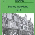 Bishop Auckland 1915 – 42.02b
Luton 1922 – 33.05
Southsea 1896 – 83.12a
Milngavie 1896
Drumsagard Hallside & Newton 1896 – 11.06
Darlington North 1896
Bishop Auckland 1915 – 42.02b
Luton 1922 – 33.05
Southsea 1896 – 83.12a
Milngavie 1896
Drumsagard Hallside & Newton 1896 – 11.06
Darlington North 1896
 New Hartley and Delaval Hall 1896
St Rollox 1894 – 6.07a
New Hartley and Delaval Hall 1896
St Rollox 1894 – 6.07a
 Barnet and Hadley 1896
Glasgow St Rollox 1933
Barnet and Hadley 1896
Glasgow St Rollox 1933
 Leeds South and South East 1906
Trafford Park South 1937
Leeds South and South East 1906
Trafford Park South 1937
 Poynton West 1896
Crook East 1896
Leeds South and South East 1890 (Colour Edition)
Poynton West 1896
Crook East 1896
Leeds South and South East 1890 (Colour Edition)
 Poplar & Canning Town 1867 – 65.1
Bulwell 1913 – 38.05
Sheffield 1921 – 294.08b
Dumbarton 1897
Sheffield Central 1903
Swinton 1901
Mexborough 1901
Broomhouse, Daldowie and Haughead 1896
Poplar 1894 – 65.2
Old Portsmouth & Gosport 1896 – 83.11a
Poplar & Canning Town 1867 – 65.1
Bulwell 1913 – 38.05
Sheffield 1921 – 294.08b
Dumbarton 1897
Sheffield Central 1903
Swinton 1901
Mexborough 1901
Broomhouse, Daldowie and Haughead 1896
Poplar 1894 – 65.2
Old Portsmouth & Gosport 1896 – 83.11a