Disclosure : This site contains affiliate links to products. We may receive a commission for purchases made through these links.
Birmingham Canal Navigations Heron Map
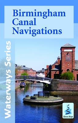
A tourist map of the Birmingham Canal Navigations is at extra large scale of 1:30,000, with a detailed town plan of Central Birmingham at 1:10,000. Suitable for both waterways and leisure users.This map gives detailed coverage of the BCN with emphasis on the waterways and information useful and relevant to users of the waterways without neglecting other leisure users. The map detail is complimented by information panels and photographs.Includes navigation and historical information, visitor moorings, marinas and boatyards, boat hire centres, facilities for the boat user, sailing and boat clubs, shops, post offices and distance markers. Information for the tourist includes tourist information centres, places of interest, pubs, nature reserves, parks, gardens and open areas, churches, national cycle routes, long distance paths, public toilets, youth hostels and towpath access points.One of the world’s most intricate canal networks, the Birmingham Canal Navigations originally totalled some 160 miles; sadly a significant amount has been lost, but the remaining 100 miles still leave much to see and explore.Gas Street Basin in the city centre was once the hub of the network, whilst the working boats may have disappeared it’s still bustling, only now with pleasure craft. The basin is a mixture of both old and new, restored canal buildings, vibrant restaurants, bars and cafรฉs, entertainment venues like the International Convention Centre, National Indoor Arena and theatres, as well as just being minutes from shopping centres and New Street Station. Despite much of the BCN being urban, there are quieter waters to be found meandering through more suburban and rural areas such as the lock free Wyrley and Essington Canal.To see the list of other titles in this series, please click on the series link.

Related Products:
 Grand Union Canal – Birmingham to Milton Keynes Heron Maps
 Oxford Canal: Oxford to Hawkesbury Junction & to Coventry Basin Heron Map
 Warwickshire Ring, Ashby-de-la-Zouch Canal & up to Fradley Junction Heron Map
 Walking the Grand Union Canal from London to Birmingham: 153 Mile Walk from the River Thames at Bentford to Gas Street Basin, Birmingham. Can be Done in 9 Stages
 Grand Union Canal: Braunston to Kings Langley Heron Map
 Kennet & Avon Canal – River Avon Heron Map
 Four Counties Ring & Caldon Canal Heron Map
 Monmouthshire and Brecon Canal – and Crumlin Arm Heron Map
 Shropshire Union Canal, incl. Middlewich Branch & up to Gr. Haywood Junction Heron Map
 Grand Union Canal: Stoke Bruerne to Leicester, River Soar & Erewash Canal Heron Map
 Grand Union Canal: Milton Keynes to London, with the London & East London Rings Heron Map
 Stourport Ring & Droitwich Ring Heron Map
 Leeds and Liverpool Canal – Liverpool to Keighley Heron Map
 Leeds & Liverpool Canal – Foulridge to Leeds; Aire & Calder to Knottingley; Calder & Hebble Heron Map
 Grand Union Canal – Braunston to Kings Langley Heron Map
Great Britain: Heron Canal Maps
Grand Union Canal – Braunston to Kings Langley Heron Map
Great Britain: Heron Canal Maps
 Llangollen and Montgomery Canal Heron Maps
 Waterways Guide 3 – Birmingham and the Heart of England
 Birmingham & the Heart of England Collins Nicholson Waterways Guide 3
 River Thames & Thames Path Heron Map
 Severn, Avon & Birmingham Collins Nicholson Waterways Guide 2
 Waterways Guide 2 – Severn, Avon & Birmingham
 Canal and River Cruising Planner of Great Britain
 Avon Ring and Droitwich Ring Heron Map
 Birmingham Greenways Cycle Map
 River Thames and the Thames Path Heron Maps
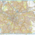
 Birmingham A-Z Pocket Street Map
 50 Miles Around Birmingham A-Z Wall Map
 South Midlands & Warwickshire Ring Pearson`s Canal Companion
 Birmingham A-Z Street Atlas
 Birmingham North 1913
 Birmingham – Walsall, Solihull & Redditch OS Explorer Map 220 (paper)
 Great Britain Collins Nicholson Inland Waterways Map
 Birmingham – Walsall, Solihull & Redditch OS Explorer Active Map 220 (waterproof)
 Birmingham Central 1913
 Birmingham A-Z Street Plan Wall Map
Birmingham Central 1902-1911
Birmingham A-Z Street Plan Wall Map
Birmingham Central 1902-1911
 Birmingham, Wolverhampton & The Black Country OS Landranger Map 139 (paper)
 Great Britain: Inland Waterways` Maps
 Birmingham, Wolverhampton & The Black Country OS Landranger Active Map 139 (waterproof)