Disclosure : This site contains affiliate links to products. We may receive a commission for purchases made through these links.
Bike Trumps 2

Related Products:
 Bike Trumps Playing Cards
 Cuba by Bike: 35 Bike Rides on the Caribbean`s Biggest Island
 Sauerland Bike Area Mountain Bike Atlas
 Top Trumps Volcanoes
 Top Trumps Dinosaurs
 Top Trumps Skyscrapers
 Top Trumps Wonders of the World
 Top Trumps London Things To See
 Top Trumps Creatures of the Deep
 Top Trumps Guinness World Records
 Top Trumps Harry Potter Phoenix
 Top Trumps Harry Potter Goblet of Fire
 Top Trumps Harry Potter Deathly Hallows 2
 Top Trumps Harry Potter Greatest Witches and Wizards
Bike Repair Kit Tin
Around the World by Bike
Top Trumps Harry Potter Greatest Witches and Wizards
Bike Repair Kit Tin
Around the World by Bike
 Could a Penguin Ride a Bike?
 The Ultimate Bike Book
 Swaledale by Bike: Cycle Map
 Flying Fergus 1: The Best Birthday Bike
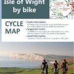 Isle of Wight by Bike Cycle Map
 South Limburg Hike & Bike Map
 Bahnradroute Hellweg – Weser: BIKE.016
 Lake District Off-Road Bike Routes
 Back in the Frame: Cycling, belonging and finding joy on a bike
 Great Britain: Mountain Bike Routes UK Guides
 Exmoor, North Devon & the Quantocks Off-Road Bike Routes
 Great Britain: Goldeneye Mountain Bike Route Maps
 France: Chamina Maps of Long-distance Mountain Bike Routes
 One Man and His Bike
 It`s All About The Bike
 It`s Not About The Bike
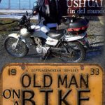 Old Man on a Bike
 Need for the Bike
 My Book of Bike Activities: A Wheelie Good Book
 Purbeck by Bike
 New Forest by Bike
 Bike Nation
Bordeaux by Bike
Paris by Bike
Bike Nation
Bordeaux by Bike
Paris by Bike