Disclosure : This site contains affiliate links to products. We may receive a commission for purchases made through these links.
Bicentennial Geological Map of Britain 1815-2015
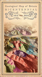
Geological map of the United Kingdom (i.e. Northern Ireland is included) at 1:1,000,000 from the British Geological Survey, in a special bicentennial edition depicting modern geological bedrock data in the style of the first ever geological map of Britain published in 1815 by William Smith. The base map has satellite-derived relief plus the road network.The whole country is shown on one side, accompanied by six cross-sections and a legend which provides separate index and explanatory information for its northern and southern halves. The maps full official title and the dedications follow the charming style of early 19th century publications. A small panel shows the original 1815 map with explanatory notes.

Related Products:
 Bicentennial Geological Map of Britain 1815-2015 Wall Map
 Geological Map 1815 William Smith
 England, Wales and Southern Scotland Geological Map 1815 by William Smith
 South Georgia BAS Geological Map 4
 STRATA: William Smith`s Geological Maps
 James Ross Island BAS Geological Map 5
 The South Sandwich Islands Volcanic Arc BAS Bathymetry and Geological Map 6
 Eastern Graham Land BAS Geological Map 1
 France IGN Geological Map 904
 Nepal Geological Map
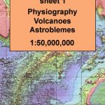 Geological Map of the World, Sheet 1: Physiography, Volcanoes, Astroblemes
 Iceland Geological Map
 Dolomiti di Sesto Geological Hiking Map
Geological map of Northern Ireland (Q)
Dolomiti di Sesto Geological Hiking Map
Geological map of Northern Ireland (Q)
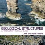 Geological Structures: An Introductory Field Guide
 British Isles Geological MEDIUM
British Isles Geological SMALL
British Isles Geological MEDIUM
British Isles Geological SMALL
 Future Mapping Company Geological Wall Maps of the World
Geological Map of Switzerland
Future Mapping Company Geological Wall Maps of the World
Geological Map of Switzerland
 BEDMAP2 Bedrock Topography of Antarctica BAS
 Geological map of the British Islands BGS
UTM Series Geological Maps
Geological map of the British Islands BGS
UTM Series Geological Maps
 WWI Trench Map: Ploegsteert Geological Map (28 SW 4 – ed. 6)
World Geological Wall Map LARGE, PAPER
WWI Trench Map: Ploegsteert Geological Map (28 SW 4 – ed. 6)
World Geological Wall Map LARGE, PAPER
 24 Hours at Waterloo: 18 June 1815
 BEDMAP2 Bedrock Topography of Antarctica BAS Wall Map
 Great Britain: Sustrans/CycleCity Cycling Maps of Great Britain & Northern Ireland
 British Islands Geological BGS Wall Map
 World Geological Wall Map MEDIUM, PLASTIC-COATED
 World Geological Wall Map LARGE, PLASTIC-COATED
 Colliding Continents: A geological exploration of the Himalaya, Karakoram, and Tibet
 England and Wales: A New Geological Map 1820
 Summer Rail Times for Great Britain – May 2015 to December 2015
 United Kingdom South BGS Bedrock Geology Pack
United Kingdom South Bedrock Geology BGS Wall Map
United Kingdom South BGS Bedrock Geology Pack
United Kingdom South Bedrock Geology BGS Wall Map
 Geological Map of Scotland c1860
 World Future Mapping Geological Wall Map – Copper – Lemon – Pink – Jade – Tangerine PAPER
 The Rocks of Wales – BGS Geological Map of Wales
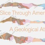 A Slice through America: A Geological Atlas
 Africa`s Top Geological Sites