Disclosure : This site contains affiliate links to products. We may receive a commission for purchases made through these links.
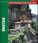
Bhutan Political Map – The Land of the Thunder Dragon
Bhutan on an indexed general map at 1:400,000 from the Kathmandu-based Nepa Maps, showing the country’s administrative dzongkhags (districts) in different colours and with subdivisions into gewogs. Presentation of the road network emphasises main roads and, although selected trekking trails are also marked, several locations are shown on the map without any access to them. Topography is indicated only by names and heights of selected peaks and passes. Locations of various temples are highlighted. Latitude and longitude lines are drawn at 30’ intervals. The map is indexed and additionally includes a panel listing names of various roads with distances.Also provided are very basic plans of Thimphu City and Paro showing locations of various places of interest and facilities.

Related Products:
 Bhutan & Northeast India ITMB
 Bhutan Himalaya Trekking Map
 Bhutan Reise Know-How
 Hidden Bhutan – Kingdom of the Thunder Dragon
 Bhutan Great Himalaya Trail Map
 Bhutan Himalaya
 Bhutan: The Land of Serenity
 Vietnam ITMB
 Nepal Adventure Map
 Jerusalem & Holy Land ITMB
 Senegal & Gambia ITMB
 United Kingdom NGS Adventure Map 3325
 Bosnia-Herzegovina F&B Top 10 Tips
 Guatemala NGS Adventure Map 3110
 South America Global Mapping Political Wall Map PAPER
 Quito & Central Ecuador ITMB
 World F&B Political Wall Map LARGE
 Middle East: Maps International Political Wall Map
 Kazakhstan Political Gizi Map
 Kosovo F&B Top 10 Tips
 Albania ITMB
 Saudi Arabia & Kuwait ITMB
 Azerbaijan Reise Know-How
 India Northeast Reise Know-How
 Kazakhstan Political Wall Map
 North Macedonia F&B Top 10 Tips
 Bulgaria Cartographia Road Map
 World F&B Political Wall Map MEDIUM
 Macedonia Road Map
 USA Reise Know-How
Kamchatka & Eastern Siberia ITMB
USA Reise Know-How
Kamchatka & Eastern Siberia ITMB
 Western Cape Map Studio Pocket Map
 Georgia & Armenia ITMB
 Future Mapping Company Monochrome Political World Wall Map PAPER
Italy F&B Great Road Atlas SPIRAL-BOUND
Future Mapping Company Monochrome Political World Wall Map PAPER
Italy F&B Great Road Atlas SPIRAL-BOUND
 World: Freytag & Berndt Political Wall Maps
 World F&B Political Wall Map MEDIUM – with Metal Hanging Strips
 Colombia ITMB
 Future Mapping Company Monochrome Political World Wall Map MAGNETIC
 South East Asia Global Mapping Political Wall Map PAPER