Disclosure : This site contains affiliate links to products. We may receive a commission for purchases made through these links.
Bhutan & Northeast India ITMB
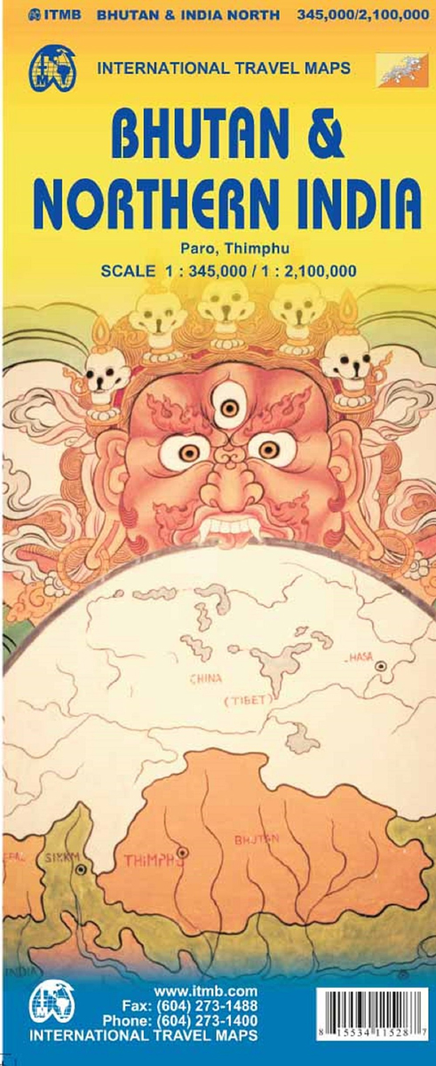
Bhutan at 1:345,000 on an indexed map from ITMB showing its topography by altitude colouring and highlighting places of interest, plus street plans of Thimpu and Paro annotated with useful tourist information and on the reverse a map of the northern half of India at 1:2,100,000.On one side is Bhutan on a map with altitude colouring but in rather broad bands for such a mountainous country (in metres: 50, 200, 500, 1000, 2000, 3000, 5000 plus glaciers). National Parks are highlighted. Road network includes selected local track. No driving distances are marked. Symbols indicate various places of interest including campsites, religious temples, etc. Also shown are the country’s internal administrative boundaries with names of the provinces. The map is indexed and has latitude and longitude lines at intervals of 30’. Street plan of Thimpu indicates locations of selected hotels, places of interest, etc. and is indexed for streets and points of interest. A more general plan of the Paro area shown roads, including access to the airport, and is indexed for points of interest and public buildings.On the reverse is an indexed road map at 1:2,100,000 of the northern half of India extending south beyond Kolkata/Calcutta, Bhopal and Ahmadabad to Nagpur and Raipur. The north-eastern states are shown as an inset. Altitude colouring shows the topography.

Related Products:
 Sikkim & India Northeast ITMB
 Delhi & Northern India ITMB
 Sri Lanka & India South ITMB
 Bangladesh & India East ITMB
 India South & North East ITMB
 India North East & Kolkata / Calcutta ITMB
 India: ITMB Regional Road Maps
 India Northeast – Bangladesh Nelles
 India North and West ITMB
Lebanon & Beirut ITMB
India North and West ITMB
Lebanon & Beirut ITMB
 India North Borch
 India Northeast NGS Adventure Map 3012
 India Northeast Reise Know-How
 Iran & Tehran ITMB
 India ITMB
Bhutan Political Map – The Land of the Thunder Dragon
India ITMB
Bhutan Political Map – The Land of the Thunder Dragon
 Pakistan ITMB
 Hanoi – Vietnam North ITMB
 Seattle & Northwest USA ITMB
 Chile ITMB
Sydney & Australia East ITMB
Chile ITMB
Sydney & Australia East ITMB
 Quito & Central Ecuador ITMB
 Tehran & Northern Iran ITMB
 Qatar and Doha City ITMB
 Hong Kong & Region ITMB
 Namibia ITMB
 A Naturalist`s Guide to the Garden Flowers of India: Pakistan, Nepal, Bhutan, Bangladesh & Sri Lanka
 Zurich & Switzerland NW ITMB
 Bhutan Reise Know-How
 Jordan & Syria ITMB
 Naturalist`s Guide to the Birds of India: Including Pakistan, Nepal and Bhutan
 Lima & Central Peru ITMB
 Taiwan & Taipei ITMB
 Barcelona & Catalonia ITMB
 Shanghai & China South East ITMB
 Philadelphia & Mid-Atlantic States ITMB
 Montreal & Southern Quebec ITMB
 Ethiopia & Eritrea ITMB
 Jerusalem & Holy Land ITMB
 Munich & Bavaria ITMB