Disclosure : This site contains affiliate links to products. We may receive a commission for purchases made through these links.
Bethnal Green & Bow 1870 – 52.1
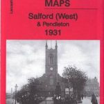
Bethnal Green and Bow in 1870 in a fascinating series of reproductions of old Ordnance Survey plans in the Alan Godfrey Editions, ideal for anyone interested in the history of their neighbourhood or family. Three versions of this map have been published, stretching from Cambridge Road eastward to Fairfield Road, and from Morpeth Road southward to Cephas Street. The eastern part of Bethnal Green is covered, and the map also includes Globe Town, part of the Mile End Road, Old Ford and the western part of Bow. Features include the southern part of Victoria Park, Hertford Union Canal, Waterloo House (earlier referred to as Workhouse), Bethnal Green Museum, Bethnal House, Coborn Road station, Meath Gardens, People`s Palace, Regent`s Canal, City of London Hospital for Diseases of the Chest, Bow Institution, Guardians Institution, Bow Road station, Old Ford Coal and Goods station, Globe Bridge, Tower Hamlets Cemetery, tramways, Bancrofts Hospital, City of London Union Workhouse, Tredegar Square, etc. Various street directory extracts are on the reverse. About the Alan Godfrey Editions of the 25″ OS Series:Selected towns in Great Britain and Ireland are covered by maps showing the extent of urban development in the last decades of the 19th and early 20th century. The plans have been taken from the Ordnance Survey mapping and reprinted at about 15 inches to one mile (1:4,340). On the reverse most maps have historical notes and many also include extracts from contemporary directories. Most maps cover about one mile (1.6kms) north/south, one and a half miles (2.4kms) across; adjoining sheets can be combined to provide wider coverage.FOR MORE INFORMATION AND A COMPLETE LIST OF ALL AVAILABLE TITLES PLEASE CLICK ON THE SERIES LINK.

Related Products:
 Bethnal Green & Bow 1914 – 52.3
 Bethnal Green & Bow 1894 – 52.2
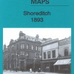 Shoreditch 1893 – 51.2
 Shoreditch 1872 – 51.1
 Shoreditch 1914 – 51.3
 Hackney 1870 – 41.1
 The Boss of Bethnal Green, Joseph Merceron the Godfather of Regency London
 Finsbury Park & Stroud Green 1870 – 20.1
 Winson Green and Hockley 1903
Winson Green and Hockley 1888
Winson Green and Hockley 1903
Winson Green and Hockley 1888
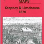 Stepney & Limehouse 1870 – 64.1
Euston & Regent`s Park 1870 – 49.1
Stepney & Limehouse 1870 – 64.1
Euston & Regent`s Park 1870 – 49.1
 Southall Green 1935
Wylde Green 1913
Southall Green 1935
Wylde Green 1913
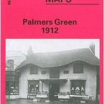 Palmers Green 1912 – 7.14a
Willenhall & Darlaston Green 1888 – 63.09a
Palmers Green 1912 – 7.14a
Willenhall & Darlaston Green 1888 – 63.09a
 Wavertree and Broad Green 1905
 Clerkenwell, King`s Cross & The Angel 1871 – 50.1
 Clerkenwell, King`s Cross & The Angel 1894 – 50.2
Kensal Green & West Kilburn 1865 – 47.1
Hall Green 1903
Kensal Green & Queen`s Park 1894 – 47.2
Wood Green 1912 – 7.3
Clerkenwell, King`s Cross & The Angel 1894 – 50.2
Kensal Green & West Kilburn 1865 – 47.1
Hall Green 1903
Kensal Green & Queen`s Park 1894 – 47.2
Wood Green 1912 – 7.3
 Wood Green 1894 – 7.2
 Wood Green 1935 – 7.4
Glasgow Green 1892
Wood Green 1935 – 7.4
Glasgow Green 1892
 Brixton & Herne Hill 1870 – 116.1
 Manchester SE & Ardwick 1932 – 104.11b
Manchester South-East 1915
Manchester SE & Ardwick 1932 – 104.11b
Manchester South-East 1915
 Dalston 1870 – 40.1
 Greets Green 1902
Norwich (North) 1905 – 63.11
Langham Place & Fitzrovia 1870 – 7.52
Greets Green 1902
Norwich (North) 1905 – 63.11
Langham Place & Fitzrovia 1870 – 7.52
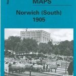 Norwich (South) 1905 – 63.15
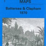 Battersea & Clapham 1870 – 101.1
Nottingham NW (New Basford & Hyson Green) 1913 – 38.13
Plymouth North 1893
Battersea & Clapham 1870 – 101.1
Nottingham NW (New Basford & Hyson Green) 1913 – 38.13
Plymouth North 1893
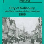 City of Salisbury with West Harnham & East Harnham 1900 – 66.15
 Lewisham 1914 – 119.3
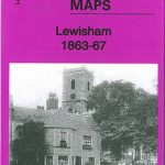 Lewisham 1863-67 – 119.1