Disclosure : This site contains affiliate links to products. We may receive a commission for purchases made through these links.
Beskid Zywiecki
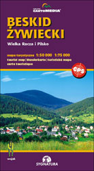
Beskid Zywiecki at 1:50,000 on a contoured and GPS compatible map from CartoMedia highlighting waymarked hiking trails, mountain huts and campsites, places of interest, etc, plus street plans of local towns and resorts: Zywiec, Sucha Beskidzka and Makรณw Podhalanski.Maps in the Cartomedia hiking series present topography is by contours at 20m intervals, enhanced by relief shading and, where appropriate, graphic relief for exposed rocky areas. Waymarked hiking trails indicate approximate walking times in both directions and possible danger points. Most titles also show cross-country and alpine ski routes and mountain bike trails. Symbols mark various types of tourist accommodation including mountain huts and campsites, mountain rescue and medical facilities, places of interest, etc. Road network indicates scenic routes, petrol stations and border crossings for motorized traffic. The maps have latitude and longitude lines at 1’ intervals. Map legends include English.On the reverse most titles carry additional tourist information, including directories of accommodation and other relevant tourist facilities, street plans, etc.PLEASE NOTE: to see the list of all the titles in this series please click on the series link.

Related Products:
 Beskid Maly
 Beskid Zywiecki ExpressMap Tourist Map
 Western Tatras – Polish and Slovak
 Beskid Sadecki ExpressMap Tourist Map
 Beskid Slaski ExpressMap Tourist Map
 Beskid Niski ExpressMap Tourist Map
 Beskid Wyspowy ExpressMap Tourist Map
 Beskid Maly i Makowski ExpressMap Tourist Map
 Mรกtra Cartographia Tourist Map 14
 Borzsony Cartographia Tourist Map 5
 Bรผkk Cartographia Tourist Map 29
 Vรฉrtes Cartographia Tourist Map 20
 Zselic Cartographia Tourist Map 17
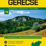 Gerecse Cartographia Tourist Map 10
Gemenc – Szekszard-Hills Tourist Map
Gerecse Cartographia Tourist Map 10
Gemenc – Szekszard-Hills Tourist Map
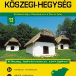 Koszeg Hills Cartographia Tourist Map 13
 Buda Hills Cartographia Tourist Map 6
 Danube Bend Cartographia Tourist Map 31
 Orsรฉg – Gรถcsej – Kemeneshat Cartographia Tourist Map 21
 Cserhat – Karancs – Medves Cartographia Tourist Map 8
 Mecsek – Villรกny Mountains Cartographia Tourist Map 15
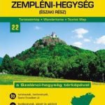 Zemplen Hills North Cartographia Tourist Map 22
Pilis – Visegrad Hills Cartographia Tourist Map 16
Szigetkoz – Tokoz – Czilizkoz
Zemplen Hills North Cartographia Tourist Map 22
Pilis – Visegrad Hills Cartographia Tourist Map 16
Szigetkoz – Tokoz – Czilizkoz
 Zemplen Hills South Cartographia Tourist Map 23
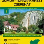 Gรถmรถr – Tornai-Karszt – Cserehรกt Cartographia Tourist Map 1
Hungary: Cartographia Hiking Maps
Gรถmรถr – Tornai-Karszt – Cserehรกt Cartographia Tourist Map 1
Hungary: Cartographia Hiking Maps
 Lake Balaton Cartographia Tourist Map 4
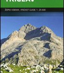 Triglav Pocket Map
 Beskid Slaski
Beskid Sadecki
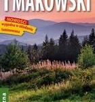
Beskid Makowski
Beskid Niski
Beskid Slaski
Beskid Sadecki
Beskid Makowski
Beskid Niski
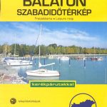 Lake Balaton Cartographia Leisure Map
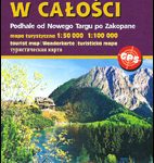 Tatra Mountains PL/SK
 Bled Pocket Map
 Lake Balaton II West Cartographia Water Sports & Cycling Map
 Gorenjska
 Ljubljana and Environs