Disclosure : This site contains affiliate links to products. We may receive a commission for purchases made through these links.
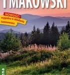
Beskid Sadecki

Beskid Sadecki in a series of detailed maps of Poland’s most popular recreational areas, showing waymarked hiking and cycling routes and various types of overnight accommodation, including local hotels, youth hostels, shelters and mountain huts, campsites, camping on local farms, etc. The maps also show various sport and recreational facilities: swimming pools, equestrian and watersport centres, etc. A wide range of other symbols highlight places of interest, local restaurants and bars, fuels supplies and other facilities. The base map is contoured (interval 5m, 10m, or 20m depending on the terrain), with, where appropriate, relief shading and graphic relief to enhance the presentation of the terrain. The maps also indicate various types of vegetation or land use. Road network includes unsurfaced country tracks and railway lines show local stations. The maps have 1km UTM grid. *Map legend includes English.*IN THIS TITLE: Beskid Sadecki from the valley of the Dunajec in the west and north-west to Krynica, Tylicz i Muszynka in the south-east, including part of the Pieniny chain and Gรณry Grybowskie, part of Beskid Niski.

Related Products:
 Beskid Sadecki ExpressMap Tourist Map
 Beskid Makowski
Beskid Slaski
Beskid Niski
Beskid Makowski
Beskid Slaski
Beskid Niski
 Beskid Maly i Makowski ExpressMap Tourist Map
 Beskid Maly
 Beskid Zywiecki
 Beskid Niski ExpressMap Tourist Map
 Beskid Wyspowy ExpressMap Tourist Map
 Beskid Wyspowy
 Beskid Slaski ExpressMap Tourist Map
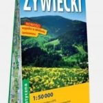 Beskid Zywiecki ExpressMap Tourist Map
Nida River
Beskid Niski: Eastern Part
Beskid Niski: Western Part
Bieszczady
Gรณry Sowie
Gรณry Swietokrzyskie
Pogรณrze Ciezkowickie
Warsaw Southern Environs
Klodzko Region (2-map set)
Krakรณw and Environs
Krakรณw ‘“ Czestochowa Jura
Babia Gรณra and Environs
Warsaw: Northern Environs
Puszcza Biala and Puszcza Kamieniecka
Niepolomice – Puszcza Niepolomicka
Kampinoski National Park
Mazowiecki Regional Park
Gorce
Podhale – Tatras – Orawa – Spisz
Oswiecim (Auschwitz) and Environs
Poland: Compass Hiking Maps
Beskid Zywiecki ExpressMap Tourist Map
Nida River
Beskid Niski: Eastern Part
Beskid Niski: Western Part
Bieszczady
Gรณry Sowie
Gรณry Swietokrzyskie
Pogรณrze Ciezkowickie
Warsaw Southern Environs
Klodzko Region (2-map set)
Krakรณw and Environs
Krakรณw ‘“ Czestochowa Jura
Babia Gรณra and Environs
Warsaw: Northern Environs
Puszcza Biala and Puszcza Kamieniecka
Niepolomice – Puszcza Niepolomicka
Kampinoski National Park
Mazowiecki Regional Park
Gorce
Podhale – Tatras – Orawa – Spisz
Oswiecim (Auschwitz) and Environs
Poland: Compass Hiking Maps
 Rakiura / Stewart Island – North West Circuit Rakiura NP
 West Virginia Recreational Atlas & Gazetteer
 Eifel West – Schneifel 35K Kรผmmerly + Frey Map No. 34
 Great Britain: CroydeCycle Local Walking Maps of the West Country
 Golden Bay
 Routeburn, Greenstone and Caples Tracks
 Lake Balaton II West Cartographia Water Sports & Cycling Map