Disclosure : This site contains affiliate links to products. We may receive a commission for purchases made through these links.
Bernese Oberland East – Goms K+F Cycling Map 22

Bernese Oberland East: Interlaken – Grindelwald – Jugfrau Region – Furka Pass area at 1:60,000 in Kรผmmerly + Frey’s series of cycling maps published in co-operation with the Association for Transport and Environment and showing the official ‘Cycling in Switzerland” routes. The aim of the series is to present a network of routes with as few problems as possible caused by motor traffic. The maps have a detailed base, with contours plus graphic relief and shading providing an excellent representation of the terrain. Routes are classified according to the density of motorized traffic, the difficulty of the terrain, and road restrictions. Unsurfaced roads are indicated, gradient marks show steep inclines, and local danger spots are highlighted. The maps show facilities for transporting cycles by train, bus, ferries, mountain railways, chair lifts, and cable cars. Border crossings indicate those open only to hikers and cyclist during daylight hours. Bike rental facilities are marked and towns with special bicycle-friendly accommodation are highlighted. Other tourist information includes various types of accommodations (campsites, youth hostels, ‘Friends of Nature” houses, etc), viewpoints, picnic sites, swimming pools, and places of interest. Each title covers an area of approximately 60 x 42 km (37 x 26 miles). The maps have a 1km grid for GPS users, with latitude and longitude shown as margin ticks. Map legend includes English. On the reverse, an index of towns and villages also lists names of geographical features such as mountains, alpine passes, glaciers, etc. Also included is general information on the country’s long-distance cycling routes and on transporting bikes by train (text includes English).To see the list of titles in this series please click on the series link.

Related Products:
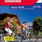 Bernese Oberland – Simmental K+F Cycling Map 16
 Geneva K+F Cycling Map 17
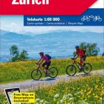 Zurich K+F Cycling Map 6
 Aargau K+F Cycling Map 5
 Emmental K+F Cycling Map 10
 Bern Region K+F Cycling Map 9
 Solothurn – Biel/Bienne – Olten 60K K+F Cycling Map No. 19
 Schaffhausen – Winterthur K+F Cycling 1
 Basel – Aarau 60K K+F Cycling Map No. 4
 St. Gallen – Appenzell – Toggenburg K+F Cycling 7
 Lugano – Locarno – Bellinzona K+F Cycling Map 18
 Lake Constance – Thurgau K+F Cycling Map 2
 Glarus – Schwyz – Klausenpass 60K K+F Cycling Map No. 12
 Lausanne – Vallรฉe de Joux K+F Cycling Map 14
 Lower Valais – Sion K+F Cycling Map 20
 Sarganserland – Walensee – Chur K+F Cycling Map 13
 Gruyere – Montreux – Chateaux-d`Oex K+F Cycling Map 15
 Jura: Delรฉmont ‘“ Biel/Bienne 60K K+F Cycling Map No. 3
 Neuchรขtel – Trois Lacs – Seeland – Fribourg K+F Cycling Map 8
 Switzerland: Kรผmmerly + Frey 60K Cycling Maps
 Upper Valais / Oberwallis K+F Cycling Map 21
 Bernese Oberland Holiday Map
 East Tyrol Cycling Atlas
 East Frisia Cycling Map
 East Westphalia Cycling Map
 Lausitz – East Erzgebirge Cycling Map 14
 East Westphalia – Sauerland Cycling Map 11
 East Frisia Cycling Region Bikeline Map-Guide
 East Friesland – Emsland Cycling Map 5
 Upper Bavaria East – Chiemsee – Inn Cycling Map 27
 Bernese Oberland – over 100 walking routes in the Bernese Alps
 Drenthe East Cycling Map
 Denmark East Bikeline Cycling Map-Guide
Ruhr Region East Cycling Map
Denmark East Bikeline Cycling Map-Guide
Ruhr Region East Cycling Map
 Drenthe East – Southeast Groningen Falkplan Cycling Map
 Goms – Aletsch
Bernese Oberland Swisstopo 5004
Goms – Aletsch
Bernese Oberland Swisstopo 5004
 Aletsch – Goms K+F Hiking Map 25
 East Jutland Cycling Nordisk Map 4/8
 Austria: Freytag & Berndt Cycling Maps