Disclosure : This site contains affiliate links to products. We may receive a commission for purchases made through these links.
Bern – Wohlensee – Gantrisch
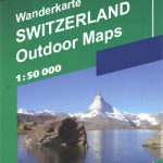
The environs of Bern extending south-east to Thun presented at 1:50,000 on a waterproof and tear-resistant, contoured and GPS compatible map from the Hallwag/Kรผmmerly + Frey group, with route profiles, grading for the severity of the terrain and the degree of fitness required, etc.The cartography provides an excellent picture of the terrain through contours at 25-metre intervals enhanced by shading, graphic relief for exposed rock, and colouring for glaciers and woodlands. All local footpaths are on the maps, but the overprint specifically highlights 33 trails selected by the publishers in collaboration with Geo-tracks. The colouring of each trail indicates the degree of fitness needed, from ‘no physical shape required” to ‘extremely high level of physical fitness necessary”. The trails start near a railway station or a bus stop (the colouring of the road network indicates routes with public transport and locations of individual bus stops). The maps have the lines of the Swiss national grid at 1-km intervals. On the reverse each trail has a route profile, its grading according to severity of the terrain and the degree of fitness required to attempt it, details of length and approximate timing, the change in altitude on assent and descent, plus a brief description. Map legend includes English; all the text on the reverse is in German. Each title also includes a code for a free download onto a smartphone.To see other titles in this series please click on the series link.USEFUL TIP: the same cartography, reduced slightly to 1:60,000, is used in Kรผmmerly + Frey’s hiking series with highlighting for all the waymarked trails rather than, as in this series, just a selection of 33 special routes recommended by the publishers.

Related Products:
 Gotthard
 Nationalpark K+F Hiking 16
 Appenzellerland – Sรคntis
 Heidiland – Flumserberg
 Brig – Aletsch – Goms
 Jura – Franches-Montagnes
 Baselland – Wasserfallen
 Zurich Oberland
 Maggia – Verzasca – Locarno – Ascona
Aargau – Wasserschloss Schweiz K+F Hiking 10
Maggia – Verzasca – Locarno – Ascona
Aargau – Wasserschloss Schweiz K+F Hiking 10
 Saanenland: Gstaad – Lenk – Adelboden
Oberengadin – Bernina K+F Hiking 07
Saanenland: Gstaad – Lenk – Adelboden
Oberengadin – Bernina K+F Hiking 07
 Lake Luzern – Luzern – Rigi – Pilatus
Jungfrau Region – Grindelwald K+F Hiking 4
Lake Luzern – Luzern – Rigi – Pilatus
Jungfrau Region – Grindelwald K+F Hiking 4
 Lugano – Mendrisiotto – Locarno
 Saas-Fee – Saastal – Simplon Pass
Zermatt – Matterhorn K+F Hiking 13
Saas-Fee – Saastal – Simplon Pass
Zermatt – Matterhorn K+F Hiking 13
 Switzerland: Hallwag/K+F 33 Hiking Trails Maps
 Gantrisch – Schwarzenburgerland
 Gantrisch Swisstopo SKI 253S
 Bern K+F Hiking Map 9
 Bern Region K+F Cycling Map 9
 Numbur Cheese Circuit
 Gantrisch Swisstopo Hiking 253T
 Bern Swisstopo Hiking 243T
 Rolwaling Region Great Himalaya Trail Map
 Lower Manaslu Community Based Eco Trail
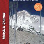 Makalu Region Great Himalay Trail Map
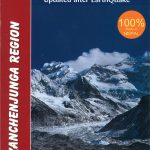 Kanchenjunga Region Great Himalaya Trail Map
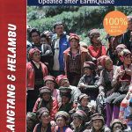 Langtang & Helambu Great Himalaya Trail Map
 Nepal`s Far West – Api & Saipal Himal – Khaptad & Rapa NP – Humla Great Himayala Trail Map
 Lausanne – Bern Swisstopo 104
 Indigenous Peoples Trail
 Brac Island
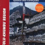 Solu Khumbu – Everest Region Great Himayala Trail Map
 Mustang Great Himalaya Trail Map
 Urzulei
 Kanchenjunga
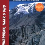 Annapurna, Naar & Phu Great Himalaya Trail Map
 Zug – Schwyz Mountain Bike Map