Disclosure : This site contains affiliate links to products. We may receive a commission for purchases made through these links.
Bermondsey & Wapping 1872 – 77.1
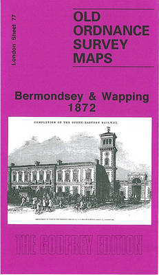
Bermondsey and Wapping in 1872 in a fascinating series of reproductions of old Ordnance Survey plans in the Alan Godfrey Editions, ideal for anyone interested in the history of their neighbourhood or family. Three versions cover the area stretching from London Bridge eastward to Southwark Park and southward to New Kent Road and Spa Road. Major features include London Bridge station, Tower Bridge, St Saviour`s Dock, Tooley Street, Jamaica Road, Southwark Cathedral, Borough Market, St James`s church, Spa Road station, numerous small works, and wharves beside the Thames. The map also includes a small but interesting section north of the Thames, where features include part of the Tower, most of St Katharine`s Docks, London Western Dock, Wapping Basin, Wapping High Streeet.About the Alan Godfrey Editions of the 25″ OS Series:Selected towns in Great Britain and Ireland are covered by maps showing the extent of urban development in the last decades of the 19th and early 20th century. The plans have been taken from the Ordnance Survey mapping and reprinted at about 15 inches to one mile (1:4,340). On the reverse most maps have historical notes and many also include extracts from contemporary directories. Most maps cover about one mile (1.6kms) north/south, one and a half miles (2.4kms) across; adjoining sheets can be combined to provide wider coverage.FOR MORE INFORMATION AND A COMPLETE LIST OF ALL AVAILABLE TITLES PLEASE CLICK ON THE SERIES LINK.

Related Products:
 Bermondsey & Wapping 1894 – 77.2
 Bermondsey & Wapping 1914 – 77.3
 Rotherhithe 1894 – 78.2
 Rotherhithe 1914 – 78.3
 Rotherhithe 1868 – 78.1
 Shoreditch 1872 – 51.1
 London Bridge Station 1872-1893
 Central Liverpool 1906 – 106.14b
Central Liverpool 1890 – 106.14a Colour Edition
Poplar 1894 – 65.2
Central Liverpool 1906 – 106.14b
Central Liverpool 1890 – 106.14a Colour Edition
Poplar 1894 – 65.2
 Poplar 1914 – 65.3
 Poplar & Canning Town 1867 – 65.1
Paddington 1872 – 60.1
Liverpool Wapping 1864
Poplar & Canning Town 1867 – 65.1
Paddington 1872 – 60.1
Liverpool Wapping 1864
 Swansea 1897 – 24.05
 Workington North 1923
 Waterloo & Southwark 1914 – 76.3
Greenwich 1894
Waterloo & Southwark 1914 – 76.3
Greenwich 1894
 Goole 1905
 Lower Clapton 1913 – 31.3
 Greenwich and the Isle of Dogs 1913
 Greenwich and the Isle of Dogs 1867
Bootle Docks & Seaforth 1907 – 99.13
Greenwich and the Isle of Dogs 1867
Bootle Docks & Seaforth 1907 – 99.13
 Kirkdale 1906
Guildford 1895
Kirkdale 1906
Guildford 1895
 Waterloo & Southwark 1894 – 76.2
Brentford 1935 – 83.4
Waterloo & Southwark 1894 – 76.2
Brentford 1935 – 83.4
 Blackhill and Shotley Bridge 1895
 Hull (Hessle Road) 1928 – 240.06b
Ipswich 1902 – 75.11
Hull (Hessle Road) 1928 – 240.06b
Ipswich 1902 – 75.11
 Hull Alexandra Dock 1908
 Bethnal Green & Bow 1914 – 52.3
 Bethnal Green & Bow 1894 – 52.2
Bethnal Green & Bow 1870 – 52.1
Ipswich South-West 1902
West Hartlepool 1914 – 37.11c
Bethnal Green & Bow 1894 – 52.2
Bethnal Green & Bow 1870 – 52.1
Ipswich South-West 1902
West Hartlepool 1914 – 37.11c
 Kingston upon Thames 1895 – 6.16
 Hammersmith & Fulham 1894 – 86.2
 Birkenhead 1909 – 13.03b
 Lewisham 1914 – 119.3