Disclosure : This site contains affiliate links to products. We may receive a commission for purchases made through these links.
Categories
-
Best Sellers
-
The Universe NGS Wall Map PAPER
The Universe map by the National Geographic Society attempts to give a sense of the enormous size of our universe and the relative scale of the Read More » -

Arcachon Blay-Foldex Street Plan
This title is part of an extensive series of street plans of French towns from Blay-Foldex, the country’s largest, oldest and most experienced publisher of urban Read More » -

Sorsele
Topographic survey of Sweden at 1:100,000, the Vรคgkartan, from the Lantmรคteriet, covering most of the country in 79 double-sided maps. Please note: the mountainous regions of Read More » -

Wicklow Mountains Harvey Superwalker XT30
Harvey Superwalker Wicklow Mountains map at 1:30,000 scale. Clear, easy to use, waterproof. GPS compatible.Includes the spectacular Glendalough area and sections of St Kevin`s Way, and Read More » -

Hampshire & Isle of Wight Sustrans Cycle Map 6
Hampshire and the Isle of Wight Cycle Map at 1:110,000 from Sustrans, including the Calleva Trail, the South Downs Way, and Round the Island Cycle Route, Read More » -

The Alps – A Cultural History
The Alps in the Landscapes of the Imagination guide series; providing an in-depth cultural and account of some of the world’s most memorable and evocative landscapes. Read More » -

Dolomiti di Brenta Tabacco 053
Dolomiti di Brenta area in a series of Tabacco maps at 1:25,000 covering the Dolomites and the mountains of north-eastern Italy – Stanfords’ most popular coverage Read More » -

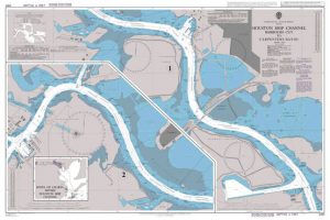
Admiralty Chart 3187 – Houston Ship Channel Barbours Cut to Carpenters Bayou
NEW EDITION OUT ON 28/05/2020Admiralty standard nautical charts comply with Safety of Life at Sea (SOLAS) regulations and are ideal for professional, commercial and recreational use. Read More » -

Espalion – Estaing IGN 2438SB
Topographic survey of France at 1:25,000 in IGN`s excellent TOP25 / Sรฉrie Bleue series. All the maps are GPS compatible, with a 1km UTM grid plus Read More » -

ล alek Valley
In the north, the map reaches the Austrian border, in the south to Prebold, in the east to Vitanje and in the west to Meลพica. On Read More »
-


