Disclosure : This site contains affiliate links to products. We may receive a commission for purchases made through these links.
Categories
-
Best Sellers
-

Paradises
“In contemporary Argentine literature, “Paradises” is an almost perfect novel.”–“Tonica”Albert Camus`s “The Outsider” reimagined with a female lead in in twenty-first-century Buenos Aires.Recently widowed, a young Read More » -
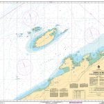
CHS Chart 1223 – Chenal du Bic and approaches
The official Canadian charts provide an excellent range of scales for the whole length of Canada`s coastline as well as the Grat Lakes and comply with Read More » -

Australasia Political Wall Map: PAPER
Large 120 x 100cm paper political map of Australasia from Maps International, at a scale of 1:7,000,000.Countries are shown in vivid colours against light blue oceans. Read More » -
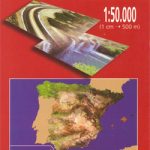
Huelva CNIG Topo 999
Topographic coverage of mainland Spain at 1:50,000 in the MTN50 (Mapa Topogrรกfico Nacional) series from the Centro Nacional de Informaciรณn Geografica, the country’s civilian survey organization. Read More » -

Mt Erymanthos Anavasi 8.61
Mt Erymanthos in a series of waterproof and tear-resistant hiking maps at scales varying from 1:50,000 to 1:10,000, with a UTM grid for GPS users. Contour Read More » -

WWI Trench Map: Meaulte (62D NE 2 – ed. 2B))
Meaulte (62D NE 2 – ed. 2B) in a series of British Army trench maps from the WWI, reproduced by G.H. Smith & Son at approximately Read More » -

St Pancras Station Through Time
With its famous hotel, St Pancras is now the London terminus of the Eurostar, with a high speed rail link to the Kent coast and the Read More » -

Walks Along the East Jurassic Coast – Studland to Portland
From the Publisher of the highly acclaimed Jurassic Coast Official Guide, Coastal Publishing Limited is a fast growing publisher with an expanding list of books of Read More » -

Hiking and Cycling in the Black Forest: Walks, treks and cycle rides in southern Germany
15 day walks, 3 multi-stage treks and 5 cycle routes are described covering the north, central and southern areas of Germany`s Black Forest. The walks and Read More » -

Pico de Navachica CNIG Topographic Map 1041-III
Topographic coverage of mainland Spain at 1:25,000 published by the Centro Nacional de Informaciรณn Geograficรก, the country’s civilian survey organization. The maps have contours at 10m Read More »
-


