Disclosure : This site contains affiliate links to products. We may receive a commission for purchases made through these links.
Belgium South Michelin Regional 534
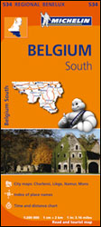
Southern Belgium with Luxembourg at 1:200,000 in a series of regional road maps of the Benelux countries from Michelin. Insets show enlargements of the areas around Liรจge, Charleroi, Namur and Mons, plus a street plan of central Mons. Michelin’s regional coverage of the Benelux is available either on indexed road maps at 1:200,000 or as a Road Atlas of Benelux with the North of France, presented with the same mapping but enlarged for greater clarity to 1:150,000; Luxembourg is additionally covered on a similarly enlarged map. The mapping has Michelin’s traditional detailed presentation of the road network, with full or limited motorway interchanges, road width of smaller roads, height and load restrictions, tolls, gradients on steep roads, swing bridges, etc. Scenic routes are highlighted. Ferry routes indicate connections for car transport or pedestrians/cycles only. Railway lines are shown with stations. Symbols mark various places of interest including campsites, bungalow parks and selected other accommodation, sport and recreational facilities, bulb fields and windmills, etc. Also indicated are locations with street plans in the publishers’ Red Guides to hotels and restaurants in Belgium and Luxembourg and in the Netherlands. Topography is presented by relief shading and colouring for woodlands; national parks and other protected areas are highlighted. Latitude and longitude lines are drawn at 10’ intervals (maps only, not in the atlas). In maps, the index is next to the map. Map legend includes English.To see the list of the titles in this series please click on the series link.

Related Products:
 Belgium North & Centre Michelin Regional 533
 Netherlands South Michelin Regional 532
 Netherlands North Michelin Regional 531
 Benelux: Michelin Regional Road Maps and Atlases
 Luxembourg Michelin
 Benelux Michelin
 Belgium & Luxembourg Michelin 716
 Belgium – Luxembourg 2021 Michelin
 Italy South Michelin Regional 564
 Benelux – North France Michelin Road Atlas SPIRAL-BOUND
 Wales – South West England – Midlands Michelin Regional 503
 Portugal South Michelin Regional 593
 South East England – Midlands – East Anglia Michelin Regional 504
 Italy Central Michelin Regional 563
 Poland South West Michelin Regional 557
 Belgium – Netherlands – Luxembourg Marco Polo Road Atlas
 Italy North West Michelin Regional 561
 Italy North East Michelin Regional 562
 Galicia Michelin Regional 571
 Germany Southwest Michelin Regional 545
 Germany North West Michelin Regional 541
 Andalucia Michelin Regional 578
 Northern England – Midlands Michelin Regional 502
 Balearic Islands Michelin Regional 579
 Aragon – Catalonia Michelin Regional 574
 Germany Mideast Michelin Regional 544
 Asturias – Cantabria Michelin Regional 572
 Castilla y Leon – Madrid Michelin Regional 575
 Comunidad Valenciana – Murcia Michelin Regional 577
 Portugal Central Michelin Regional 592
 Germany Southeast – Bavaria Michelin Regional 546
 Portugal North Michelin Regional 591
 Germany Northeast Michelin Regional 542
 Germany: Michelin Regional Road Maps
 Basque Country – Navarra – La Rioja Michelin Regional 573
 Extremadura – Castilla-la Mancha – Madrid Michelin Regional 576
 France: Michelin 200K Regional Road Maps
 Scotland Michelin Regional 501 WATERPROOF
 Scotland Michelin Regional 501
 Brittany Michelin Regional 512