Disclosure : This site contains affiliate links to products. We may receive a commission for purchases made through these links.
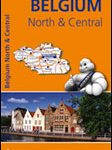
Belgium NGI Road Map
Belgium on a double-sided road map at 1:250,000 from the Nationaal Geografisch Instituut / Institut Geographique National, the country’s national survey organization, with an index of place names in a separate booklet. The map has topographic base with contours at 50m intervals, but without relief shading to emphasise more hilly regions such as the Ardennes. Colouring shows woodlands, orchards, etc.Road network is graded according to widths and the number of lanes; motorway junctions are clearly numbered and service or rest areas are marked. Railway lines are shown with stations. Some places of tourist interest are also indicated. Within Flanders some place names are given in their bilingual version (Mesen / Messines), others only in Flemish, so Ieper and not Ypres. The map has latitude and longitude margin ticks at 1’ intervals. Map legend includes English.

Related Products:
 France, Belgium & the Netherlands AA Road Map
 Belgium F&B
 Crimea Road Atlas
 Belgium – Netherlands – Luxembourg Marco Polo Road Atlas
 Belgium South Michelin Regional 534
 Ukraine: Kartografija 500K Road Maps
 Ukraine Kartografija Road Atlas 500K HARDBACK
 Ukraine Road Atlas (500K, Spiral-bound)
 South Africa Map Studio Road Atlas A4 PAPERBACK
 France & Belgium Philip`s Road Map
 Belgium North & Centre Michelin Regional 533
 France, Belgium & the Netherlands Philip`s Road Atlas
 Latvia Jana Seta Road Atlas
 Belgium – Luxembourg Hallwag Road Map
 Netherlands & Belgium ITMB
 Belgium – Luxembourg
 Karelia Karttakeskus Road Map
 Israel 100 Recommended Sites Road Map
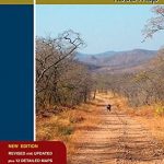 Zambia Road Map
 Bavaria North – Saxony – Thuringia K+F Regional Road Map
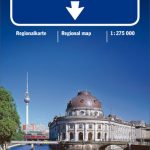 Berlin – Brandenburg – Saxony-Anhalt K+F Regional Road Map
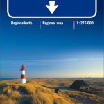 North Sea Coast – Bremen – Hamburg K+F Regional Road Map
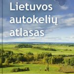 Lithuania Jana Seta Road Atlas HARDBACK
Europe Railway & Road ITMB
Bavaria South – Munich – Upper Bavaria K+F Road Map 8
Lithuania Jana Seta Road Atlas HARDBACK
Europe Railway & Road ITMB
Bavaria South – Munich – Upper Bavaria K+F Road Map 8
 North Rhine-Westphalia – Cologne – Ruhr Area K+F Regional Road Map
 Germany: Kรผmmerly+Frey 275K Regional Road Map
 France, Belgium and Netherlands NGS Executive Wall Map PAPER
 Taiwan & Taipei ITMB
 France, Belgium and Netherlands NGS Classic Wall Map PAPER
 Texas USA 09 Hallwag Road Map
 Great Lakes USA 03 Hallwag Road Map
 Belgium and Neighbouring Regions: Sportoena 50K Cycling Maps
 Finland East Karttakeskus Road Map
 Latvia Jana Seta Compact Road Atlas
 Western Europe Railroad & Road ITMB
Finland North Karttakeskus Road Map
Western Europe Railroad & Road ITMB
Finland North Karttakeskus Road Map
 Deep South USA 10 Hallwag Road Map
Finland Karttakeskus Road Atlas
Deep South USA 10 Hallwag Road Map
Finland Karttakeskus Road Atlas
 Finland West Karttakeskus Road Map