Disclosure : This site contains affiliate links to products. We may receive a commission for purchases made through these links.
Belfast (East) 1902 – 4.11
Belfast East in 1902 in a fascinating series of reproductions of old Ordnance Survey plans in the Alan Godfrey Editions, ideal for anyone interested in the history of their neighbourhood or family. The map covers part of east Belfast, east of the Lagan. Note that the Co Antrim area west of the Lagan is left blank. Coverage stretches from Albert Bridge and Ormeau Park eastward to Castlereagh Road, and from Newtownards Road southward to Ravenhill Avenue. Features include Ormeau Park, Cromac Distillery, Lagan Engine Works, Albert Bridge, Queen`s Bridge (at top margin), Chemical Manure Works, Cromac Brewery, tramways and Mountpottinger depot, St Ann`s Iron Works, Belfast Felt Works, Willowfield House, Loopbridge Weaving Factory, jam factory, Castlereagh Laundry, Loopbridge Printing Works, Avoneil Distillery, St Patrick`s church, Nettlefield, Ravenhill Presbyterian church, St Clement`s church, etc. On the reverse are street directory entries for Albertbridge Road, Castlereagh Street, Ravenhill Road, Ravensdale Street and Templemore Avenue. About the Alan Godfrey Editions of the 25″ OS Series:Selected towns in Great Britain and Ireland are covered by maps showing the extent of urban development in the last decades of the 19th and early 20th century. The plans have been taken from the Ordnance Survey mapping and reprinted at about 15 inches to one mile (1:4,340). On the reverse most maps have historical notes and many also include extracts from contemporary directories. Most maps cover about one mile (1.6kms) north/south, one and a half miles (2.4kms) across; adjoining sheets can be combined to provide wider coverage.FOR MORE INFORMATION AND A COMPLETE LIST OF ALL AVAILABLE TITLES PLEASE CLICK ON THE SERIES LINK.

Related Products:
 Belfast Bloomfield 1902
Belfast Knockdene Park 1902
Central Belfast 1931 – 61.09
Sydenham and Strandtown 1902
Belfast North 1920
Worcester North-East 1902
Belfast Bloomfield 1902
Belfast Knockdene Park 1902
Central Belfast 1931 – 61.09
Sydenham and Strandtown 1902
Belfast North 1920
Worcester North-East 1902
 Ipswich 1902 – 75.11
Ipswich South-West 1902
Leicester North West 1902
Ipswich 1902 – 75.11
Ipswich South-West 1902
Leicester North West 1902
 Belfast, Down & Armagh Cycle Map
Bristol (NE) 1902 – 72.13a
Worcester South-East 1902
Belfast, Down & Armagh Cycle Map
Bristol (NE) 1902 – 72.13a
Worcester South-East 1902
 The Falls 1931 – 60.12
Dundee East 1901
Worcester South-West 1902
Bristol (SW) & Bedminster 1902 – 75.04a
The Falls 1931 – 60.12
Dundee East 1901
Worcester South-West 1902
Bristol (SW) & Bedminster 1902 – 75.04a
 Sheffield Hillsborough 1902
Dundonald 1902
Sheffield Hillsborough 1902
Dundonald 1902
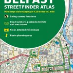 Belfast Collins Streetfinder Colour Atlas
 Hull North East 1908
Leeds Central and North East 1890
Southampton (East) 1908 – 65.11a
Hull North East 1908
Leeds Central and North East 1890
Southampton (East) 1908 – 65.11a
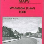 Whitstable East 1906
Bangor East 1901
East Ham & Barking 1915 – 44.3
Carlisle South-East 1924
Bristol (St George) 1902 – 72.14
Bristol Fishponds 1902
Swindon South-East 1899
Whitstable East 1906
Bangor East 1901
East Ham & Barking 1915 – 44.3
Carlisle South-East 1924
Bristol (St George) 1902 – 72.14
Bristol Fishponds 1902
Swindon South-East 1899
 Leeds East 1906
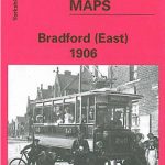 Bradford East 1906
East Jarrow 1913
West Bromwich 1902 – 68.10b
Bradford East 1906
East Jarrow 1913
West Bromwich 1902 – 68.10b
 Great Bridge and Toll End 1902
Wincobank & Meadowhall 1902 – 289.13a
Great Bridge and Toll End 1902
Wincobank & Meadowhall 1902 – 289.13a
 Croydon East: Coombe Park & Addiscombe Road 1895 – 158
Glasgow East End 1893
Langley and Londonderry 1902
Tenbury 1902
Glasgow North East 1893
Croydon East: Coombe Park & Addiscombe Road 1895 – 158
Glasgow East End 1893
Langley and Londonderry 1902
Tenbury 1902
Glasgow North East 1893