Disclosure : This site contains affiliate links to products. We may receive a commission for purchases made through these links.
Belfast Bloomfield 1902
Belfast Bloomfield in 1902 in a fascinating series of reproductions of old Ordnance Survey plans in the Alan Godfrey Editions, ideal for anyone interested in the history of their neighbourhood or family. The map covers parts of east Belfast, east of the Lagan. Coverage stretches from Conn`s Water and Belfast Rope Works eastward to Greenwood, and from Dundela Avenue southward to Orangefield house. Features include Belfast Rope Works, Grove Weaving Factory, Grove Mill, tramways and Knock tram depot, Knock Nursery, Belmont Park area, Greenwood area, Dundela House, Upper Newtownards Road area, Belfast & County Down Railway with Neill`s Hill station, St Columba`s church, Ballyhackamore, Knock River, Neill`s Hill, St Donard`s church, Clara Park, Loop Bridge, Holywood Arches, many villas, plus terraces nearer the city, Knock church (in ruins), Bloomfield House, etc. On the reverse is a selection of street directory entries, including Cheviot Avenue, Cyprus Avenue/Gardens/Park, King`s Road, Moorfield Street, Moorgate Street, Newtownards Road Upper, Nevis Avenue and Ravenscroft Street. *About the Alan Godfrey Editions of the 25″ OS Series:Selected towns in Great Britain and Ireland are covered by maps showing the extent of urban development in the last decades of the 19th and early 20th century. The plans have been taken from the Ordnance Survey mapping and reprinted at about 15 inches to one mile (1:4,340). On the reverse most maps have historical notes and many also include extracts from contemporary directories. Most maps cover about one mile (1.6kms) north/south, one and a half miles (2.4kms) across; adjoining sheets can be combined to provide wider coverage.FOR MORE INFORMATION AND A COMPLETE LIST OF ALL AVAILABLE TITLES PLEASE CLICK ON THE SERIES LINK.

Related Products:
 Belfast Knockdene Park 1902
Belfast (East) 1902 – 4.11
Sydenham and Strandtown 1902
Belfast North 1920
Central Belfast 1931 – 61.09
Belfast Knockdene Park 1902
Belfast (East) 1902 – 4.11
Sydenham and Strandtown 1902
Belfast North 1920
Central Belfast 1931 – 61.09
 Sheffield Longley 1902
 Bristol Fishponds 1902
Bristol (St George) 1902 – 72.14
Bristol Fishponds 1902
Bristol (St George) 1902 – 72.14
 South Acton & Gunnersbury Park 1935 – 71.4
Worcester South-West 1902
Tenbury 1902
Dundonald 1902
South Acton & Gunnersbury Park 1935 – 71.4
Worcester South-West 1902
Tenbury 1902
Dundonald 1902
 Liverpool Princes Park 1905
 Handsworth 1913
Worcester North-East 1902
Bristol (NE) 1902 – 72.13a
Worcester North-West 1902
Bristol (SW) & Bedminster 1902 – 75.04a
Tranmere & Oxton 1909
Griffin`s Hill 1902
Handsworth 1913
Worcester North-East 1902
Bristol (NE) 1902 – 72.13a
Worcester North-West 1902
Bristol (SW) & Bedminster 1902 – 75.04a
Tranmere & Oxton 1909
Griffin`s Hill 1902
 Upper Edmonton 1894 – 3a
 Upper Sydenham 1894 – 137.2
Ipswich 1902 – 75.11
Upper Sydenham 1894 – 137.2
Ipswich 1902 – 75.11
 Brixton & Herne Hill 1894 – 116.2
Brixton & Herne Hill 1913 – 116.3
Brixton & Herne Hill 1894 – 116.2
Brixton & Herne Hill 1913 – 116.3
 Brixton & Herne Hill 1870 – 116.1
Ipswich South-West 1902
Newtownards 1901
Teddington & Hampton Hill 1894 – 131.2
Brixton & Herne Hill 1870 – 116.1
Ipswich South-West 1902
Newtownards 1901
Teddington & Hampton Hill 1894 – 131.2
 Croydon 1895 – 157
Bristol Knowle 1902
Leicester North West 1902
Croydon 1895 – 157
Bristol Knowle 1902
Leicester North West 1902
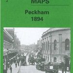 Peckham 1894 – 103.2
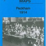 Peckham 1914 – 103.3
Peckham 1871 – 103.1
Peckham 1914 – 103.3
Peckham 1871 – 103.1
 Liverpool Edge Hill 1905
 Bloxwich 1902
Wood Green 1912 – 7.3
Bloxwich 1902
Wood Green 1912 – 7.3
 Wood Green 1894 – 7.2
 Wood Green 1935 – 7.4