Disclosure : This site contains affiliate links to products. We may receive a commission for purchases made through these links.
Belarus F&B

Belarus at 1:700,000 on a road map from Freytag & Berndt with the index booklet also providing a street plan of central Minsk. Place names are shown transliterated, but with names of larger cities also in the Cyrillic alphabet. Road network includes selected local tracks, gives driving distances on main routes and shows locations of border crossings. Railway lines are included, local airports are marked, and the maps also shows internal administrative boundaries with names of the provinces. Latitude and longitude lines are drawn at 1ยฐ intervals. The index is in a separate booklet attached to the map cover and lists all locations with their postcodes. Map legend includes English/

Related Products:
 Belarus Jana Seta Road Map
 Belarus ITMB
 Belarus (English Edition)
 Belarus Road Atlas
Belarus (Cyrillic edition)
Belarus
Belarus Road Atlas
Belarus (Cyrillic edition)
Belarus
 Middle East F&B
 Poland: Reise-Know-How Touring Maps with Historic Place Names
 Poland Southeast Reise Know-How
 Myanmar / Burma F&B
 Ukraine – Moldova F&B
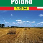 Poland 500K F&B
 Namibia F&B
 North Macedonia F&B Top 10 Tips
 Poland Southwest Reise Know-How
 Malawi Map Studio Adventure Map
 Lithuania Jana Seta Road Map
 China – Mongolia – Taiwan F&B
 Algeria F&B
 Best of Albania
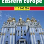 Europe Eastern F&B
 Albania F&B Top 10 Tips
 Ecuador F&B
 Iran Gizi Map
 Central Asia F&B
 Turkmenistan Gizi Map
 Spain – Portugal F&B
 Iran Wall Map
 China Gizi Map Geographical Wall Map
 Peru F&B
 Zambia F&B
Kabul & Historic Khyber Pass ITMB
Zambia F&B
Kabul & Historic Khyber Pass ITMB
 Albania North
 Portugal F&B
Turkmenistan Gizi Wall Map
Portugal F&B
Turkmenistan Gizi Wall Map
 Togo & Benin ITMB
 Poland 700K F&B
 Cuba NGS Adventure Map 3112
 Albania South