Disclosure : This site contains affiliate links to products. We may receive a commission for purchases made through these links.
BEDMAP2 Bedrock Topography of Antarctica BAS Wall Map
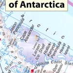
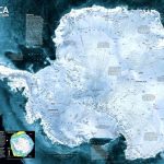
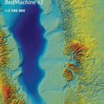
Bed topography wall map of Antarctica, size 87x88cm (34.5″x34.5″ approx), presenting the continent as it would stand if stripped of its ice cover. Around the main map and on the reverse are numerous additional map panels and notes providing a fascinating insight on how the information used on this unusual map was gathered.Based by the British Antarctic Survey on Bedmap 2 ‘“ a large collaborative international project involving around 60 scientists from 35 institutions in 14 countries ‘“ the map was produced in 2013 from various types of data used to calculate the thickness of Antarctica’s ice cover. The result, in bright colouring for the bed height above the sea level and the depth below it, presents a much altered picture from the one offered by conventional maps of the Antarctic. The map has latitude and longitude lines at 15ยบ and also shows the lines of the four cross-section panels which accompany it. Several more panels, photos and explanatory notes provide more information about the Bedmap 2 Project, plus full technical specifications including data sources and references. Full BAS reference for this title is “BAS (Misc) 9”. This title is also available in a folded format.PLEASE NOTE: to see other BAS maps of wider general interest please click on the series link. A separate series on our website presents BAS titles which are of interest mainly to scientific experts or academic staff: larger scale topographic or geological/earth sciences maps of sections of the Antarctic and maps accompanied by detailed booklets/monographs.

Related Products:
 BEDMAP2 Bedrock Topography of Antarctica BAS
 Antarctica and the Arctic BAS Wall Map
 Antarctica and the Arctic BAS
 Antarctica Maps International Wall Map PAPER
 Antarctica NGS Satellite Image Wall Map ENCAPSULATED
Antarctica: Maps International Wall Maps
Antarctica NGS Satellite Image Wall Map ENCAPSULATED
Antarctica: Maps International Wall Maps
 Greenland Basal Topography BedMachine v3 Wall Map
 Antarctica de Dios Map-Guide
 Ushuaia to Antarctica – Drake Passage – Polar Voyage Log Map
 Adelaide Island And Arrowsmith Peninsula Bas Wall Map
 Before the Heroes Came – Antarctica in the 1890s
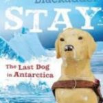 Stay: The Last Dog in Antarctica
 Antarctica Historical Map
 Antarctica Reise Know-How
 Northern Antarctic Peninsula UKAHT Wall Map
 Greenland Basal Topography BedMachine v3
 Tierra del Fuego – Antarctica
 Hillary`s Antarctica: Adventure, Exploration and Establishing Scott Base
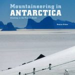 Mountaineering in Antarctica
 Antarctica – A Guide To Wildlife
United Kingdom South Bedrock Geology BGS Wall Map
Antarctica – A Guide To Wildlife
United Kingdom South Bedrock Geology BGS Wall Map
 United Kingdom North Bedrock Geology BGS Wall Map
 Chasing the Light: A Novel of Antarctica
 Terra Incognita – Travels in Antarctica
 Graham Land and South Shetland Islands – Scotia Sea
 Antarctic Atlas: New Maps and Graphics That Tell the Story of A Continent
 The Crossing of Antarctica
 Lonely Planet Antarctica
 Empire Antarctica: Ice, Silence & Emperor Penguins
 The Continent of Antarctica
 A Polar Affair: Antarctica`s Forgotten Hero and the Secret Love Lives of Penguins
 The Antarctic Dive Guide
 The South Sandwich Islands Volcanic Arc BAS Bathymetry and Geological Map 6
 Adelaide Island and Arrowsmith Peninsula BAS
 Antarctica – Tierra del Fuego ITMB
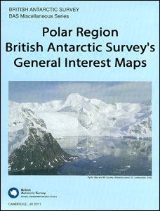
Polar Region: British Antarctic Survey`s General Interest Maps
Antarctica – Tierra del Fuego ITMB
Polar Region: British Antarctic Survey`s General Interest Maps
 Northern Antarctic Peninsula
 Busen Region – South Georgia BAS Wall Map
 St Andrews Bay – Royal Bay, South Georgia BAS Geomorphology Wall Map
 Yangzi River Odyssey Map