Disclosure : This site contains affiliate links to products. We may receive a commission for purchases made through these links.
Beckenham 1861-71 – 7.15
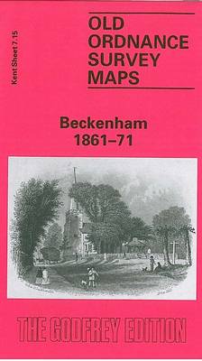
Beckenham in 1861-1871 in a fascinating series of reproductions of old Ordnance Survey plans in the Alan Godfrey Editions, ideal for anyone interested in the history of their neighbourhood or family. Three versions have been published to show how this developed across the years – the maps are from different series, for Kent and for London, and so the sheetlines are somewhat different. The Kent series maps are centred on the village, and later town centre of Beckenham. The earliest map was surveyed in 1861 but was updated to 1871 to include railways. Features include Coperscope, Beckenham station (still with an overall roof), and the map stretches as far as New Beckenham Junction to the north. Westward the map extends to the boundary with Penge, eastward it reaches Foxgrove. This is an attractive map of Beckenham as development was just beginning. The companion map showing it in 1930 provides a fascinating illustration of how the village developed into a town.Coverage of the area in 1894 is provided by the London map No. 146.About the Alan Godfrey Editions of the 25″ OS Series:Selected towns in Great Britain and Ireland are covered by maps showing the extent of urban development in the last decades of the 19th and early 20th century. The plans have been taken from the Ordnance Survey mapping and reprinted at about 15 inches to one mile (1:4,340). On the reverse most maps have historical notes and many also include extracts from contemporary directories. Most maps cover about one mile (1.6kms) north/south, one and a half miles (2.4kms) across; adjoining sheets can be combined to provide wider coverage.FOR MORE INFORMATION AND A COMPLETE LIST OF ALL AVAILABLE TITLES PLEASE CLICK ON THE SERIES LINK.

Related Products:
 Beckenham & Penge 1894 – 146
 Beckenham South 1894
 Wallasey Village 1898
Lenzie 1897
Ryhope Village 1895
Wallasey Village 1898
Lenzie 1897
Ryhope Village 1895
 Brough 1908
Dundonald 1902
Brough 1908
Dundonald 1902
 Shortlands 1894
Wylam and Clara Vale 1895
Theydon Bois 1915
Shortlands 1894
Wylam and Clara Vale 1895
Theydon Bois 1915
 West Drayton South 1935
 Dyserth and Meliden 1910
Dun Laoghaire 1908
Dyserth and Meliden 1910
Dun Laoghaire 1908
 Goathland 1910 – 45.16
Bishopbriggs 1910
Nenthead 1898
Goathland 1910 – 45.16
Bishopbriggs 1910
Nenthead 1898
 Harefield 1935
New Quay 1904
Harefield 1935
New Quay 1904
 Croydon North-East 1895
 Rainhill 1906
Norton 1896
Pelton and Urpeth 1895
Rainhill 1906
Norton 1896
Pelton and Urpeth 1895
 Greenford 1894
 Greenford 1939
 East Finchley 1894 – 10.2
 Tong 1905
Croydon Woodside 1911
South London 1893
Tong 1905
Croydon Woodside 1911
South London 1893
 Wickersley 1901
Pedmore 1921
Wickersley 1901
Pedmore 1921
 Monken Hadley 1896
Shincliffe 1895
Monk Bretton & Smithies 1904 – 274.04
Monken Hadley 1896
Shincliffe 1895
Monk Bretton & Smithies 1904 – 274.04
 Cudworth 1904
Edgware 1895
Cudworth 1904
Edgware 1895
 Edgware 1935
 Woolton 1904
Wollaston 1901 – 4.09
Lanchester 1895
Seaton Carew 1894
Woolton 1904
Wollaston 1901 – 4.09
Lanchester 1895
Seaton Carew 1894