Disclosure : This site contains affiliate links to products. We may receive a commission for purchases made through these links.
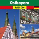
Bavaria Official Map – Standard Edition
Bavaria at 1:500,000 on an overview map from Bayerisches Landesvermessungsamt, the state’s official survey organization. The map shows the divisions of the state into regions (Regierungsbezirke) and districts (Kreise).Roads are graded according to their official classification, but are presented without driving distances or numbers/names of interchanges on the autobahns. Railway lines are shown with stations. Topography is shown by shading and graphic relief, plus colouring for woodlands. Boundaries of natural parks are marked. Also shown are restricted entry military training areas. Latitude and longitude lines are shown at intervals in 30’. The map is not indexed. Map legend includes English.

Related Products:
 Bavaria South – Munich – Upper Bavaria K+F Road Map 8
 Bavaria South – Upper Bavaria – Chiemsee – Passau – Munich 2-Map Cycling Set Kompass 3712
 Bavaria North – Saxony – Thuringia K+F Regional Road Map
 Baden-Wรผrttemberg Official Road Map
 Upper Bavaria – Lower Bavaria – Swabia F&B Road and Leisure Map
Bavaria North – Baden-Wurttemberg North/East 2-Map Cycling Set Kompass 3710
Upper Bavaria – Lower Bavaria – Swabia F&B Road and Leisure Map
Bavaria North – Baden-Wurttemberg North/East 2-Map Cycling Set Kompass 3710
 Germany Southeast – Bavaria Michelin Regional 546
 Munich & Bavaria ITMB
 Bavaria North Marco Polo Regional Map 12
 Bavaria South Marco Polo Regional Map 13
 Spain: CNIG 500K Regional Road Maps
 Russia – C. I. S. F&B
 New England – Hudson Valley Michelin Regional 581
 Galicia: Santiago de Compostela – Leรณn 500K CNIG Regional Map No.1
 Extremadura: Badajoz – Toledo – Cรณrdoba 500K CNIG Regional Map No. 8
 Madrid – Toledo – Zagaroza 500K CNIG Regional Map No. 6
 Pyrenees East – Barcelona – Costa Brava 500K CNIG Regional Map No. 4
 Barcelona – Zaragoza – Castellรณn de la Plana 500K CNIG Regional Map No. 7
 Spain North 500K CNIG 2
 Andalucรญa West: Cรณrdoba – Seville – Mรกlaga 500K CNIG Regional Map No. 11
 Valencia – Alicante – Murcia 500K CNIG Regional Map No. 9
 Pyrenees West – Zaragoza – Santander – Burgos 500K CNIG Regional Map No. 3
 Andalucรญa East: Granada – Almerรญa – Murcia 500K CNIG Regional Map No. 12
 Alaska F&B
 Salamanca – Sierra de Gredos – Madrid 500K CNIG Regional Map No. 5
 Midatlantic – Allegheny Highlands Michelin Regional 582
 Straits of Gibraltar – Costa del Sol – Almerรญa 500K CNIG Regional Map No. 13
 Venezuela F&B
 Greece 700K F&B
 Oregon
 Franconia – Altmuhltal – Bavaria East F&B Road and Leisure Map
 Romania – Moldova F&B
 Germany North F&B
 Bali – Lombok – Komodo F&B
 Bavaria South F&B
 France North F&B
 Pyrenees F&B
 Bavaria North – Middle F&B
 Germany South F&B
 France South F&B