Disclosure : This site contains affiliate links to products. We may receive a commission for purchases made through these links.
Battles of the Civil War NGS Wall Map PAPER
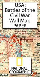
Battles of the American Civil War Wall Map, paper version, from the National Geographic Society showing the deployments of the Union and Confederate forces, battles, etc. with a time chart of major events from April 1861 to April 1865.The map covers ten of the eleven Confederate states, with just the eastern borderlands of Texas and of the Indian Territory allied to the Confederacy, plus the adjoining regions of the Union states. Movements of the two armies during major land campaigns are marked, along with battle sites, classified as decisive, major and limited. Also marked are naval campaigns by the Union with dates when various ports were captured.The main battlefield region of Virginia, between Washington DC and the area around the Confederate capital of Richmond, is shown enlarged to present the information in greater detail. A series of three smaller maps show the turning points of the war. Along the bottom of the map, a time chart shows the ‘The Most Deadly Years” from April 1861 to April 1865, with battle sites cross-referenced to the map and annotated with dates and casualty figures.* This map is also available encapsulated.

Related Products:
 Battlefields of the USA Civil War Bella Terra War Map
 War: A History in 100 Battles
 Battles of South Africa
 Battles Exploring British Battlefields
 The Greatest Battles in History: An Encyclopedia of Classic Warfare From Megiddo To Waterloo
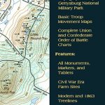 Gettysburg National Miltary Park
 American War for Independance – Battles of the Revolutionary Bella Terra War Map
 The Battles of Tolkien
 American War of Independence – War of 1812 NGS NGS Wall Map PAPER
 USA Michelin Political Wall Map PAPER
 Battles that Changed History: Epic Conflicts Explored and Explained
 USA Rand McNally Signature Wall Map PAPER
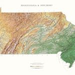
 United States NGS Physical Wall Map PAPER
 USA Rand McNally Classic Wall Map PAPER
 A History of War in 100 Battles
 Indian Country NGS Wall Map PAPER
 World War II Illustrated Atlas
 Waterloo: The History of Four Days, Three Armies and Three Battles
 United States Raven Maps Physical Wall Map PAPER
 Vermont & New Hampshire Raven Maps Physical Wall Map PAPER
 Massachusetts, Connecticut & Rhode Island Raven Maps Physical Wall Map PAPER
 Five Minute History, Great Battles of the First World War
 Pennsylvania and New Jersey Raven Maps Physical Wall Map PAPER
 United States NGS Executive Wall Map PAPER
 Battle Cry of Freedom: The Civil War Era
 Battles Map by Map
 Scotland NGS Executive Wall Map PAPER
 Tennessee Raven Maps Physical Wall Map PAPER
 Indiana Raven Maps Physical Wall Map PAPER
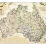 Australia NGS Executive Wall Map PAPER
 USA: The Essential Geography of the United States of America Wall Map PAPER
 Iowa Raven Maps Physical Wall Map PAPER
 Minnesota Raven Maps Physical Wall Map PAPER
 Colorado Raven Maps Physical Wall Map PAPER
 Hawaii Raven Maps Physical Wall Map PAPER
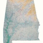 Alabama Raven Maps Physical Wall Map PAPER
 Arkansas Raven Maps Physical Wall Map PAPER
 Oklahoma Raven Maps Physical Wall Map PAPER
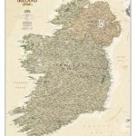 Ireland NGS Executive Wall Map PAPER
 Wisconsin Raven Maps Physical Wall Map PAPER